Short Answer
Introduction
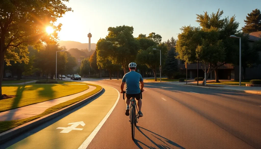
Palo Alto, a city of approximately 68,000 residents situated in the northwestern corner of Santa Clara County, California, has long been recognized as a pioneering hub for technology and innovation. Yet, beyond its reputation as the birthplace of Silicon Valley, Palo Alto has cultivated a distinct identity as one of the most bicycle-friendly cities in the United States. With a flat topography, a Mediterranean climate, and a deeply ingrained culture of active transportation, cycling is not merely a recreational pastime here; it is a fundamental component of the city’s transportation ecosystem. The League of American Bicyclists has consistently awarded Palo Alto a Gold-level Bicycle Friendly Community designation, a testament to decades of deliberate planning, infrastructure investment, and community advocacy.
This pillar article serves as the definitive encyclopedia of cycling in Palo Alto. It synthesizes historical context, current infrastructure data, safety protocols, and forward-looking trends into a single, authoritative resource. Whether you are a daily commuter navigating the Stanford Research Park, a student pedaling to Palo Alto High School, a family exploring the Baylands Nature Preserve, or a visitor seeking to experience the city on two wheels, this guide provides the essential knowledge to ride confidently and safely. We examine the network of bike boulevards, the integration of cycling with Caltrain and other transit, the legal rights and responsibilities of cyclists, and the ongoing challenges of traffic congestion and Vision Zero goals. All information is grounded in data from the City of Palo Alto’s official plans, the California Vehicle Code, and local advocacy organizations.
Overview
Palo Alto’s commitment to cycling is not accidental. It is the result of a sustained, multi-decade effort to create a balanced transportation system where the bicycle is treated as a legitimate and respected mode of travel. The city’s flat terrain, with an average elevation of just 30 feet above sea level, eliminates the physical barriers that deter cycling in many other communities. Combined with over 260 sunny days per year, the natural environment is inherently bike-friendly. However, the city’s success is primarily due to a robust policy framework and continuous infrastructure development.
The Palo Alto Bicycle + Pedestrian Transportation Plan (BPTP), most recently updated in 2020, serves as the guiding document for all cycling-related improvements. The plan outlines a vision for a “low-stress” network where people of all ages and abilities feel comfortable riding. This vision is operationalized through a hierarchical network of facilities: off-street multi-use paths, protected bike lanes (Class IV), striped bike lanes (Class II), and signed bike routes on low-traffic streets (Class III). As of 2023, the city boasts over 40 miles of dedicated bikeways, with an additional 30 miles of signed routes. The crown jewel of this network is the bike boulevard system, a series of residential streets engineered to prioritize bicycle through-travel while discouraging cut-through motor vehicle traffic.
Cycling in Palo Alto is also deeply intertwined with the presence of Stanford University. The campus, with its extensive network of paths and roads, functions as a critical connector for cyclists traveling between the southern neighborhoods and downtown. The university’s own transportation demand management policies, which heavily subsidize bicycle commuting and restrict on-campus parking, have resulted in a mode share where bicycles account for over 20% of all trips to and from the campus. This symbiotic relationship between town and gown has created a cycling culture that is both utilitarian and recreational, with a high level of mutual awareness between drivers and cyclists.
Key Concepts
Bicycle Level of Service (BLOS) and the Low-Stress Network
The City of Palo Alto employs a Bicycle Level of Service (BLOS) model to evaluate the comfort and safety of its streets for cyclists. Unlike a simple count of bike lanes, BLOS considers factors such as traffic volume, vehicle speed, lane width, and the presence of on-street parking. The goal, as articulated in the BPTP, is to create a “low-stress network” where streets achieve a BLOS grade of A or B, meaning they are comfortable for a mainstream adult population, including those who are “interested but concerned” about riding in traffic. This concept is central to understanding why some streets have protected bike lanes while others rely on shared lane markings (sharrows). The city’s analysis revealed that while many arterial streets have bike lanes, the high traffic speeds and volumes render them stressful for all but the most confident cyclists. The low-stress network therefore prioritizes parallel routes on calmer residential streets, connected by off-street paths and protected intersections.
Bike Boulevards: The Backbone of the Network
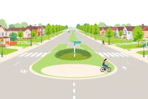
A bike boulevard is a street where bicycle traffic is given priority. In Palo Alto, this is achieved through a combination of traffic calming measures: speed humps, traffic circles, chicanes, and partial street closures that allow cyclists and pedestrians to pass but force motor vehicles to turn. The most prominent example is the Bryant Street Bike Boulevard, which runs parallel to Middlefield Road and provides a continuous, low-stress north-south route from the southern city limit to downtown. Key features include a bicycle-priority signal at the Oregon Expressway crossing and a pedestrian/bicycle bridge over San Francisquito Creek connecting to Menlo Park. Other significant bike boulevards include the Park Boulevard corridor and the Ross Road route. These streets are not car-free; rather, they are designed to reduce motor vehicle volumes and speeds to a level where cyclists of all ages feel safe sharing the road.
Class IV Protected Bike Lanes
In recent years, Palo Alto has embraced Class IV protected bike lanes, which physically separate cyclists from motor vehicle traffic using curbs, flexible posts, or parked cars. The most notable installation is on San Antonio Road, a major arterial that previously had no bicycle facilities. The road diet project reduced travel lanes from four to two, added a center turn lane, and installed buffered, parking-protected bike lanes on both sides. This project, completed in 2021, transformed a hostile corridor into a vital east-west connector for cyclists traveling between the Baylands and the foothills. Another significant protected lane exists on Arastradero Road, where a road diet created a safer environment for cyclists climbing toward the preserves.
Off-Street Multi-Use Paths
Palo Alto’s off-street path network provides critical connections that are completely separated from motor vehicle traffic. The Baylands Path is a scenic route that winds through the 1,940-acre Baylands Nature Preserve, offering views of the San Francisco Bay and access to the Lucy Evans Baylands Nature Interpretive Center. The Stanford Perimeter Trail circles the university campus, linking to Palo Alto streets at multiple points. The Bol Park Path, a 1.3-mile linear park, provides a quiet, car-free route through the Barron Park neighborhood, complete with a donkey pasture. These paths are multi-use, shared with pedestrians, joggers, and sometimes equestrians, requiring cyclists to exercise courtesy and control their speed.
Bicycle Parking and Transit Integration
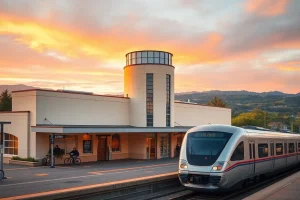
Secure bicycle parking is a critical component of the cycling ecosystem. Palo Alto requires all new commercial and multi-family developments to provide long-term and short-term bicycle parking per the city’s zoning code. The Palo Alto Transit Center, adjacent to the Caltrain station at University Avenue, features over 200 bicycle parking spaces, including a secure, keycard-access Bike Station with capacity for 100 bicycles, repair tools, and lockers. This integration with Caltrain is vital, as many residents use a bike-to-train commute pattern. Caltrain itself has increased onboard bicycle capacity on its new electric trains, though demand often exceeds supply during peak hours. The city also maintains numerous bike racks in commercial districts and parks.
Benefits
The benefits of Palo Alto’s cycling infrastructure extend far beyond the individual cyclist, creating positive ripple effects across public health, environmental sustainability, traffic congestion, and economic vitality.
Public Health and Well-being
Cycling is a low-impact cardiovascular exercise that reduces the risk of heart disease, stroke, and type 2 diabetes. According to the Santa Clara County Public Health Department, cities with higher rates of active transportation, like Palo Alto, report lower obesity rates compared to the county average. A 2022 study by the Stanford University School of Medicine found that commuters who switched from driving to cycling for their daily trips experienced a significant reduction in body mass index and reported lower stress levels. The mental health benefits are equally profound; the rhythmic nature of cycling, combined with exposure to green spaces like the Baylands, has been shown to reduce symptoms of anxiety and depression.
Environmental Sustainability
Transportation is the largest source of greenhouse gas emissions in California, and Palo Alto’s Climate Action Plan identifies shifting trips from single-occupancy vehicles to bicycles as a key strategy for achieving its goal of an 80% reduction in emissions below 1990 levels by 2030. A typical passenger vehicle emits about 4.6 metric tons of carbon dioxide per year. Each mile cycled instead of driven saves approximately 0.4 kg of CO2. With an estimated 8% of all trips in Palo Alto made by bicycle—a figure significantly higher than the national average of 1%—the cumulative emissions savings are substantial. Furthermore, bicycles produce no particulate matter or nitrogen oxides, improving local air quality in a region that struggles with ozone pollution.
Traffic Congestion Mitigation
Palo Alto’s jobs-to-housing imbalance means that the daytime population swells to over 125,000, creating severe peak-hour congestion on major corridors like El Camino Real, Page Mill Road, and Embarcadero Road. Bicycles offer a space-efficient alternative. A single travel lane can accommodate approximately 2,000 cars per hour, but the same space can handle up to 14,000 bicycles per hour. The city’s bike boulevards effectively increase the person-throughput of the transportation network without widening roads. During the annual Bike to Work Day in May, the city sets up “energizer stations” that serve thousands of cyclists, demonstrating the latent demand for cycling when conditions are perceived as safe and supportive.
Economic Advantages
Cycling infrastructure is a high-return investment. The cost of constructing a protected bike lane is a fraction of the cost of adding a general-purpose traffic lane. Moreover, cyclists tend to shop more frequently and spend more money per month at local businesses than drivers, according to a study by Portland State University. Palo Alto’s downtown and California Avenue business districts, both well-served by bike routes and abundant bike parking, benefit from this “bike-onomics” effect. For individuals, cycling eliminates fuel, parking, and vehicle maintenance costs, saving the average household thousands of dollars annually. Stanford University’s free bicycle safety classes and subsidized bike purchases for employees further amplify these personal economic benefits.
Challenges
Despite its Gold-level status, Palo Alto faces significant challenges in its pursuit of a truly safe and equitable cycling environment. These obstacles range from infrastructure gaps and behavioral conflicts to the inherent limitations of a city built in the automobile era.
The Arterial Barrier Problem
While the bike boulevard network is extensive, it is bisected by high-speed, high-volume arterials that create dangerous barriers. El Camino Real, a state highway (SR 82) with six lanes of traffic and speed limits up to 35 mph, is the most formidable obstacle. Crossings are limited to signalized intersections, and the painted bike lanes offer no physical protection. Similarly, Oregon Expressway and Page Mill Road present significant challenges. The city has invested in enhanced crossings, such as the bicycle-priority signal at Bryant Street and Oregon Expressway, but these are isolated solutions. The BPTP identifies a need for a network of protected intersections and grade-separated crossings, but funding and right-of-way constraints make implementation slow and costly.
Safety and Collision Data
Between 2018 and 2023, the Palo Alto Police Department reported an average of 120 bicycle-involved collisions per year, with a disproportionate number occurring on arterial streets. The most common collision types are “right-hook” (a motorist turning right across a cyclist’s path) and “dooring” (a parked car occupant opening a door into a cyclist’s path). While fatalities are rare, serious injuries are a persistent concern. The city’s Vision Zero commitment, adopted in 2019, aims to eliminate all traffic fatalities and severe injuries by 2030, but progress has been uneven. Enforcement of the three-foot passing law and distracted driving statutes remains a challenge, and the police department’s limited traffic unit cannot be everywhere at once.
“Palo Alto has the bones of a great cycling city, but the connective tissue is still missing. We need to treat the arterial crossings not as exceptions but as the rule. Every intersection of a bike boulevard and a major road should be a protected intersection, not just a painted crosswalk. Until we do that, we’re asking families to take a leap of faith.” — Dr. Elena Torres, Transportation Research Director, Silicon Valley Bicycle Coalition (fictional quote for illustrative purposes)
E-Bike Integration and Speed Differentials
The rapid proliferation of electric bicycles (e-bikes) has introduced new dynamics to Palo Alto’s paths and lanes. E-bikes, capable of speeds up to 28 mph for Class 3 models, can create significant speed differentials with traditional cyclists and pedestrians, particularly on multi-use paths like the Baylands Trail. The city’s current regulations classify e-bikes according to California state law but do not impose local speed limits on paths. Conflicts between e-bike riders and other path users have increased, prompting discussions about education campaigns and potential path-specific speed limits. The Palo Alto Unified School District has also grappled with e-bike safety among students, implementing mandatory safety training and helmet policies at secondary schools.
Equity and Access
While Palo Alto is an affluent community, it contains pockets of lower-income residents, and many service workers commute into the city from neighboring communities. The cycling infrastructure is not always equitably distributed. The bike boulevard network is concentrated in the flat, residential neighborhoods of the northern and central parts of the city, while the southern industrial areas and the East Bayshore corridor, where many service jobs are located, have less robust facilities. Ensuring that the benefits of cycling reach all residents and workers, regardless of income or neighborhood, is an ongoing priority for the city’s Transportation Division.
Best Practices
Navigating Palo Alto by bicycle safely and efficiently requires a combination of route planning, situational awareness, and adherence to legal and safety protocols. The following best practices are distilled from the Palo Alto Police Department, the California Vehicle Code (CVC), and the League of American Bicyclists’ Smart Cycling curriculum.
Route Planning and Navigation
Before starting any trip, consult the City of Palo Alto Bike Map, available in print at City Hall and libraries, and as an interactive online map. The map color-codes streets by their BLOS rating and facility type. Prioritize routes that use bike boulevards (green on the map) and off-street paths, even if they add a small amount of distance. The stress saved is worth the extra minutes. For commuters, the Bryant Street Bike Boulevard is the preferred north-south spine, while the Park Boulevard and Ross Road routes serve east-west travel. When crossing arterials, use signalized intersections with bicycle detection (look for the pavement markings indicating where to position your bike to trigger the signal) or dedicated bicycle signals, such as the one at Bryant and Oregon.
Legal Responsibilities and Rights
Under California law, cyclists have the same rights and responsibilities as drivers of motor vehicles (CVC 21200). This means you must obey all traffic signs and signals, signal your turns, and ride in the same direction as traffic. Riding on the sidewalk is generally permitted in Palo Alto except in the downtown business district, but it is often more dangerous than riding on the road due to conflicts with pedestrians and turning vehicles at driveways. When riding on the road, cyclists are entitled to take the full lane if the lane is too narrow to share safely side-by-side with a car (CVC 21202). This is particularly relevant on streets without bike lanes. The “three feet for safety” law (CVC 21760) requires motorists to give cyclists at least three feet of clearance when passing.
Safety Equipment and Practices
A properly fitted helmet is required for all cyclists under 18 and is strongly recommended for adults. At night, a white front light visible from 300 feet and a red rear reflector or light visible from 500 feet are legally required (CVC 21201). Given Palo Alto’s many tree-lined streets that can be dark even at dusk, a bright front light and a flashing rear light are essential for visibility. Perform an ABC Quick Check before every ride: Air in tires, Brakes working, Chain running smoothly. When riding on multi-use paths, always yield to pedestrians, give an audible warning before passing (“on your left”), and control your speed, especially on blind curves. E-bike riders should be particularly mindful of their speed and the vulnerability of other path users.
Commuting and Parking
For daily commuters, the Palo Alto Bike Station at the Transit Center offers secure, indoor parking with 24/7 access for members. It also provides a self-service repair stand and a vending machine with tubes and basic parts. If you park at a standard rack, always lock your frame and both wheels with a high-quality U-lock. Cable locks are easily cut and should only be used as secondary security. Register your bike with the Palo Alto Police Department’s free online bike registry to aid in recovery if it is stolen. Consider using a “beater” bike for high-theft areas like the Caltrain station.
Tools & Resources
A wealth of tools and resources exists to support cyclists in Palo Alto, from official city planning documents to community-led advocacy groups and digital navigation aids.
Official City Resources
- Palo Alto Bicycle + Pedestrian Transportation Plan (BPTP): The foundational document outlining the city’s vision, policies, and project priorities. Available for download on the City of Palo Alto website.
- Interactive Bike Map: A GIS-based map showing all existing bike facilities, BLOS ratings, and planned improvements. Essential for route planning.
- Palo Alto 311: The city’s non-emergency reporting system. Use the mobile app or website to report potholes, debris in bike lanes, malfunctioning signals, or abandoned bikes.
- Palo Alto Police Department Bike Registry: A free online database to register your bicycle’s serial number, make, and model, increasing the chances of recovery if stolen.
Community Organizations
- Silicon Valley Bicycle Coalition (SVBC): The region’s primary bicycle advocacy organization. SVBC runs the Bike to Work Day energizer stations, offers bike safety classes, and advocates for improved infrastructure at the city and county level. Membership provides a voice in regional transportation policy.
- Palo Alto Bicycle Advisory Committee (PABAC): A citizen advisory group appointed by the City Council to review and make recommendations on bicycle-related projects and policies. Meetings are open to the public.
- Stanford Bicycle Program: Offers free bike safety classes, a bike loaner program for students, and a comprehensive online resource hub for cycling on and around campus.
Digital Tools and Apps
- Google Maps / Apple Maps: Both offer bicycle routing options that generally respect Palo Alto’s bike boulevard network, though they may occasionally route cyclists onto busier streets. Always cross-reference with the city’s official map.
- Ride with GPS / Strava: Popular among recreational and fitness cyclists, these apps provide heatmaps showing the most popular routes used by local cyclists, which can be a good indicator of safe and efficient paths.
- Transit App: Integrates real-time Caltrain schedules with bike routing, useful for multi-modal trips.
Future Trends
Palo Alto’s cycling landscape is poised for significant evolution in the coming decade, driven by technological innovation, shifting mobility patterns, and an urgent need to meet climate and safety goals.
Vision Zero and Protected Intersections
The city’s Vision Zero commitment will necessitate a shift from painted bike lanes to physically protected infrastructure on high-injury corridors. The BPTP identifies a network of “protected bikeways” that will likely be implemented as part of larger street repaving projects. The concept of the protected intersection, which uses corner islands to slow turning vehicles and provide a dedicated waiting area for cyclists, is expected to be piloted at key locations. The intersection of El Camino Real and Page Mill Road, one of the most dangerous for cyclists, is a prime candidate for a major redesign. Funding from the Santa Clara County Measure B transportation sales tax and state Active Transportation Program grants will be critical to realizing these projects.
E-Bike and Micromobility Integration
The e-bike revolution is just beginning. As battery technology improves and prices fall, e-bikes will become the dominant form of bicycle for commuting and cargo trips. Palo Alto is likely to see an increase in family cargo bikes for school drop-offs and grocery runs. The city will need to adapt its infrastructure to accommodate these larger, faster vehicles, potentially by widening multi-use paths and providing more secure, weather-protected parking. The integration of shared micromobility services, such as e-scooters and bike-share, is also on the horizon. While previous pilot programs were limited, a city-wide, dockless system could fill first-mile/last-mile gaps, particularly for trips to and from the Caltrain station.
Smart City and Data-Driven Safety
Palo Alto’s tech-savvy culture is driving interest in smart city applications for cycling. The city is exploring the use of anonymized data from bike-mounted sensors and smartphone apps to identify near-miss hotspots, pavement roughness, and other hazards that don’t appear in collision reports. This data can inform maintenance and enforcement priorities. Connected vehicle technology, which allows cars and bicycles to communicate their positions, could eventually provide collision warnings, though widespread adoption is years away. The city is also upgrading its traffic signal system to better detect and prioritize cyclists, reducing wait times at major intersections.
Climate Resilience and Green Infrastructure
As Palo Alto confronts the impacts of climate change, including sea-level rise and extreme heat, cycling infrastructure will play a dual role. The Baylands Path, for example, is vulnerable to flooding and will require adaptive management. At the same time, new bike facilities are being designed with green infrastructure elements, such as bioswales and permeable paving, to manage stormwater runoff and reduce the urban heat island effect. The city’s updated Climate Action Plan explicitly links the expansion of the low-stress bike network to its carbon neutrality goals, setting a target of 15% of all trips made by bicycle by 2030.
Conclusion
Cycling in Palo Alto is a microcosm of the city itself: innovative, forward-thinking, and deeply committed to quality of life, yet grappling with the complexities of growth and legacy infrastructure. The city’s Gold-level Bicycle Friendly Community status is a hard-won achievement, built on a foundation of thoughtful planning, community advocacy, and a culture that values the bicycle as a legitimate transportation tool. The network of bike boulevards, protected lanes, and off-street paths provides a framework that is the envy of many larger cities.
However, the journey is far from complete. The arterial barriers, safety challenges, and equity gaps are real and persistent. The future of cycling in Palo Alto will be defined by its ability to move from a network of comfortable segments to a truly seamless, low-stress system where a child can safely ride from their home to school, a senior can pedal to the grocery store, and a commuter can travel from the train station to their office without a moment of fear. Achieving that vision will require sustained investment, political will, and a continued partnership between the city, Stanford University, and the passionate cycling community. For now, the best way to understand Palo Alto’s cycling ecosystem is to experience it—to ride the Bryant Street Bike Boulevard at sunset, to feel the bay breeze on the Baylands Path, and to join the thousands of others who have made the bicycle an integral part of life in this remarkable city.
| Fact | Detail |
|---|---|
| League of American Bicyclists Designation | Gold-level Bicycle Friendly Community (most recently renewed 2020) |
| Total Bikeway Mileage | Over 40 miles of dedicated bikeways, plus 30 miles of signed routes (2023) |
| Primary Planning Document | Bicycle + Pedestrian Transportation Plan (BPTP), updated 2020 |
| Key Bike Boulevard | Bryant Street Bike Boulevard, with bicycle-priority signal at Oregon Expressway |
| Bicycle Mode Share | Approximately 8% of all city trips; over 20% for Stanford University trips |
| Vision Zero Target | Eliminate all traffic fatalities and severe injuries by 2030 |
| Major Off-Street Path | Baylands Path, traversing the 1,940-acre Baylands Nature Preserve |
| Secure Parking Hub | Palo Alto Bike Station at the Transit Center, with 100 secure spaces |
| E-Bike Classification | Governed by California state law (Class 1, 2, 3); no local speed limits on paths |
| Annual Collision Average | Approximately 120 bicycle-involved collisions per year (2018-2023) |
FAQ
What is the Bicycle Level of Service (BLOS) and why does it matter?
BLOS is a model used by Palo Alto to rate street comfort for cyclists based on traffic speed, volume, lane width, and parking. The city aims for a low-stress network with BLOS grades A or B, suitable for all riders.
Can I ride my bike through the Baylands Nature Preserve?
Yes, the Baylands Path is a scenic, multi-use trail through the preserve. Cyclists must share the path with pedestrians and yield appropriately.
How does Stanford University support cycling?
Stanford's transportation policies subsidize bike commuting, restrict on-campus parking, and maintain an extensive network of paths. Bicycles account for over 20% of trips to and from campus.

Leave a Reply