Short Answer
One-Sentence Summary
University Avenue evolved from a dusty farm road and ceremonial Ohlone path into the commercial spine of Palo Alto, reflecting the city’s transformation from a temperance-minded railroad suburb to a global center of technology and venture capital.
Key Dates
| Date | Event |
|---|---|
| Pre-1769 | Ohlone peoples use the approximate corridor as a trail between seasonal encampments and the baylands. |
| 1887 | Leland Stanford establishes the town of University Park (later Palo Alto) and lays out University Avenue as its main street, extending from the new university to the Southern Pacific railroad station. |
| 1891 | Stanford University opens; University Avenue becomes the primary route for students and visitors arriving by train. |
| 1894 | Palo Alto incorporates as a city, with University Avenue as its commercial center. |
| 1906 | The San Francisco earthquake devastates Stanford; University Avenue businesses temporarily house university departments and benefit from the influx of refugees and reconstruction activity. |
| 1925 | Mayfield, a rival saloon town to the south, is annexed by Palo Alto, extending the reach of University Avenue’s influence. |
| 1956 | Stanford Shopping Center opens on the former Mayfield site, drawing retail away from downtown University Avenue. |
| 1980s | University Avenue undergoes a revitalization, attracting high-end boutiques, restaurants, and the first wave of tech company offices. |
| 1996 | The historic Stanford Theatre reopens after restoration, symbolizing the street’s cultural renaissance. |
| 2010s | University Avenue becomes a premier address for venture capital firms, cementing its role in Silicon Valley’s financial ecosystem. |
Geographic Setting
University Avenue runs approximately 2.5 miles from the Stanford University Oval in the west to the Bayshore Freeway (U.S. 101) in the east, crossing El Camino Real and the Caltrain tracks. The original townsite of University Park (now downtown Palo Alto) was laid out on a flat, oak-dotted plain between San Francisquito Creek to the north and the seasonal Barron Creek to the south. The western terminus at Palm Drive was once the grand entrance to the Stanford campus; the eastern end dissolved into marshlands and tidal flats of San Francisco Bay. Before Spanish colonization, the area was inhabited by the Puichon Ohlone, who used a network of trails roughly following the present-day street alignment to travel between inland villages and bay shellmounds. The modern avenue is divided into distinct segments: the Stanford-adjacent stretch with low-rise professional offices, the historic downtown core between Alma Street and Middlefield Road, and the eastern section that passes through former industrial zones and residential neighborhoods before reaching the freeway. The Caltrain tracks, laid in 1863, created a literal and symbolic boundary—west of the tracks was the “dry” university town; east of the tracks, in what was then Mayfield, saloons flourished until annexation.
Origins
University Avenue’s story begins not with a university but with a railroad. In 1863, the San Francisco and San Jose Railroad completed its line through the Peninsula, establishing a station at what is now the Palo Alto Caltrain stop. The surrounding settlement, originally called Mayfield, grew into a rough-and-tumble railroad town with hotels, saloons, and a red-light district. Leland Stanford Sr., seeking a more wholesome environment for his nascent university, purchased land west of the tracks in the 1880s and, with his agent Timothy Hopkins, platted a new temperance town called University Park. The town’s deed restrictions prohibited the sale of alcohol, a direct challenge to Mayfield’s saloon economy. University Avenue was designed as the grand axis connecting the university gates to the railroad depot, with wide lots reserved for churches, a library, and a town hall. The first building on the avenue, a wooden store and post office, was erected in 1889. According to the city inventory, the original street was unpaved and lined with eucalyptus saplings, many of which survived into the 1920s. The exact date of the first Ohlone trail is lost, but archaeological evidence suggests seasonal use of the corridor for at least 2,000 years before European contact.
Growth and Community Life
By the 1890s, University Avenue had become the commercial heart of the new city of Palo Alto (incorporated 1894). The street boasted a hardware store, a pharmacy, a bank, and the iconic Palo Alto Hotel, which stood at the corner of University and Emerson. Contemporary newspaper accounts reported that the Fourth of July parade of 1895 drew over 3,000 spectators, with floats traveling the length of the avenue from the university to the station. The 1906 earthquake proved a turning point: Stanford’s damaged buildings sent classes and administrative offices into temporary quarters along University Avenue, and the influx of San Francisco refugees spurred a construction boom. The street’s first brick commercial blocks date from this period, including the 1907 Packard Building and the 1910 Varsity Theatre, which showed silent films accompanied by a live organist. The avenue was a social stage: suffragists campaigned on its corners, and returning World War I veterans paraded under a temporary victory arch in 1919. By the 1920s, the street was fully paved, lined with electric streetlights, and served by a streetcar line that connected to Mayfield and Stanford. The President Hotel, built in 1929 at 488 University Avenue, became a landmark of Jazz Age elegance, hosting visiting dignitaries and Stanford parents.
Relationship with Nearby Powers
University Avenue’s fate has always been intertwined with Stanford University and, later, the technology industry. The university’s founding charter prohibited alcohol sales within a mile of campus, a policy that shaped the avenue’s early character and fueled the rivalry with “wet” Mayfield. Timothy Hopkins, Stanford’s trustee and the town’s de facto founder, carefully controlled land sales to ensure a moral, educated populace. The university’s growth directly fed the avenue’s economy: faculty and students patronized its bookstores and cafés, and the street became the preferred address for professional offices serving the campus. In the 1950s, however, Stanford’s decision to develop the Stanford Shopping Center on the site of the former Mayfield commercial district siphoned retail away from downtown. The university’s land-use policies, including the long-term lease of its lands rather than sale, created a unique real estate market that would later attract venture capital firms seeking prestige addresses. The symbiotic relationship was tested during the 1960s and 1970s, when anti-war protests and counterculture tensions sometimes pitted town against gown, but the avenue remained a neutral commercial ground.
Annexation, Decline, or Transformation
The annexation of Mayfield in 1925 was a pivotal moment for University Avenue’s regional role. After decades of rivalry, Palo Alto absorbed its neighbor, extending the avenue’s influence eastward and eliminating the saloon district that had long been a thorn in the temperance town’s side. The former Mayfield commercial strip along University Avenue (east of the tracks) gradually declined, and many of its buildings were demolished during mid-century redevelopment. The post-World War II era brought suburbanization and the rise of the automobile, which undermined the pedestrian-oriented downtown. By the 1970s, University Avenue was dotted with vacant storefronts, and the President Hotel had become a residential hotel for seniors. A 1976 city report described the avenue as “frayed at the edges, with an uncertain retail future.” The transformation began in the 1980s, when a new generation of entrepreneurs, many with Stanford ties, opened boutiques, restaurants, and software firms in the historic buildings. The arrival of venture capital firms like Kleiner Perkins in the 1990s cemented the avenue’s new identity. The final city council meeting of the old Mayfield government had been held in a saloon in 1925; by 2000, the same stretch of University Avenue housed a wine bar and a gourmet cheese shop, a quiet echo of the past.
What Remains Today
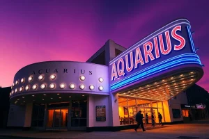
A walk along University Avenue today reveals a palimpsest of its history. The current building at 488 University Avenue, the President Hotel, still stands as a senior residence, its Art Deco lobby largely intact. The Varsity Theatre at 456 University Avenue, now a multi-screen cinema, retains its original 1910 façade and marquee. The Packard Building at 543 University Avenue, with its distinctive brickwork, houses a venture capital office. The 1907 Roth Building at 300 Homer Avenue (just off University) was Palo Alto’s first public library and now serves as a community center. The Stanford Theatre at 221 University Avenue, a 1925 movie palace, was meticulously restored in 1989 and screens classic films with a live organist, exactly as it did in the silent era. East of the tracks, the former Mayfield saloon district is largely gone, but the 1895 Mayfield Brewery building at 250 University Avenue (now offices) is a rare survivor. The street’s original eucalyptus trees are long vanished, but the median plantings between Middlefield and Alma recall the early landscaping efforts. A bronze plaque at the Caltrain station commemorates the 1894 incorporation, and the sidewalk in front of 531 University Avenue bears the faint imprint of a long-gone hitching post.
Historical Photographs and Maps
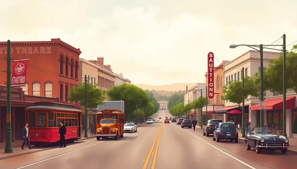
A 1908 Sanborn fire insurance map shows the original layout of University Avenue’s commercial core, with wooden frame buildings clustered between Alma and Emerson streets, a blacksmith shop at the corner of Ramona, and the railroad depot at the eastern end. The map reveals that the avenue was then only two blocks long as a commercial district, with residential lots beyond. A 1925 panoramic photograph, held by the Palo Alto Historical Association, captures the avenue on the eve of Mayfield’s annexation: streetcars, Model T Fords, and pedestrians in cloche hats throng the sidewalks, while the newly built Stanford Theatre dominates the streetscape. A 1956 aerial photograph from the U.S. Geological Survey shows the stark contrast between the dense downtown and the newly cleared land for the Stanford Shopping Center, a visual prophecy of the retail shift to come. No known photographs of the original Ohlone trail exist, but a 1856 plat map of the Rancho Rincon de San Francisquito shows the approximate route as a dotted line labeled “camino viejo.”
Historiographical Notes
Early county histories, such as the 1904 “History of Santa Clara County” by Eugene T. Sawyer, portray University Avenue as a triumph of moral planning, emphasizing the temperance vision of Leland Stanford and Timothy Hopkins while downplaying the displacement of Mayfield’s working-class community. The 1925 annexation is often framed as a progressive unification, but oral histories collected in the 1930s by the Works Progress Administration reveal lingering resentment among former Mayfield residents who felt their town had been “swallowed whole.” Recent scholarship, including Margaret Feuer’s “Palo Alto: The First Hundred Years,” has sought to recover the stories of the Chinese and Japanese immigrants who operated laundries and nurseries along the eastern end of the avenue, communities largely erased from booster narratives. The role of the Southern Pacific Railroad in shaping the street’s early economy is also understudied, as most histories focus on the university connection. The 1980s revitalization is often celebrated as a grassroots success, but critics note that rising rents displaced long-time family businesses, a tension that continues to define the avenue’s identity.
Sources and Archives
The Palo Alto Historical Association, housed in the Main Library, holds the definitive collection of photographs, city directories, and oral histories related to University Avenue. Its “Palo Alto Times” newspaper database (1893–1979) is searchable online and provides a granular view of daily life on the street. Stanford University’s Department of Special Collections contains the Timothy Hopkins Papers, including original plat maps and correspondence about the town’s founding. The California State Library’s Sanborn Fire Insurance Map collection (available digitally) offers detailed block-by-block views of the avenue in 1908, 1925, and 1950. The Mayfield Community History Project, an oral history initiative conducted in the 1970s, preserves the voices of the last generation to remember the independent town. The City of Palo Alto’s Historic Inventory (1979, updated 2001) provides architectural descriptions and significance ratings for every surviving building on the avenue.
Related People and Places
Timothy Hopkins (1859–1936): Adopted son of Leland Stanford’s brother, Hopkins was the land agent who platted University Park and enforced its temperance restrictions. He later donated the land for Hopkins Park. Sarah Wallis (1825–1905): A pioneering landowner and suffragist, Wallis owned much of the land that became Mayfield and fought the annexation. Her estate, “Fair Oaks,” stood near present-day California Avenue. Birge Clark (1893–1989): Palo Alto’s most influential architect, Clark designed many of the Spanish Colonial Revival buildings on University Avenue in the 1920s, including the President Hotel and the post office. Mayfield: The rival town east of the tracks, incorporated in 1903 and annexed in 1925. Its former commercial center is now the site of the Stanford Shopping Center. Stanford Shopping Center: Opened in 1956 on the former Mayfield site, this open-air mall drew retail away from University Avenue and remains a major regional destination. Professorville: The residential neighborhood north of University Avenue, developed in the 1890s for Stanford faculty, whose large Craftsman and Shingle-style homes still line the streets.
FAQ
Why was University Avenue originally a temperance street?
Leland Stanford Sr. and Timothy Hopkins, who founded the town of University Park (later Palo Alto), imposed deed restrictions prohibiting alcohol sales to create a moral environment for the new university. This ban lasted in various forms until 1971.
What happened to the town of Mayfield?
Mayfield, a rival saloon town east of the railroad tracks, was annexed by Palo Alto in 1925 after years of political and economic pressure. Its commercial district declined and was eventually replaced by the Stanford Shopping Center in 1956.
How did the 1906 earthquake affect University Avenue?
The earthquake severely damaged Stanford University, forcing classes and offices to relocate temporarily to buildings along University Avenue. The influx of refugees and reconstruction activity spurred a commercial building boom that gave the street many of its early brick structures.
What are the oldest surviving buildings on University Avenue?
The Varsity Theatre (1910), the Packard Building (1907), and the President Hotel (1929) are among the oldest. The Roth Building (1907) on nearby Homer Avenue was the first public library. The Mayfield Brewery building (1895) survives east of the tracks.
Leave a Reply