Short Answer
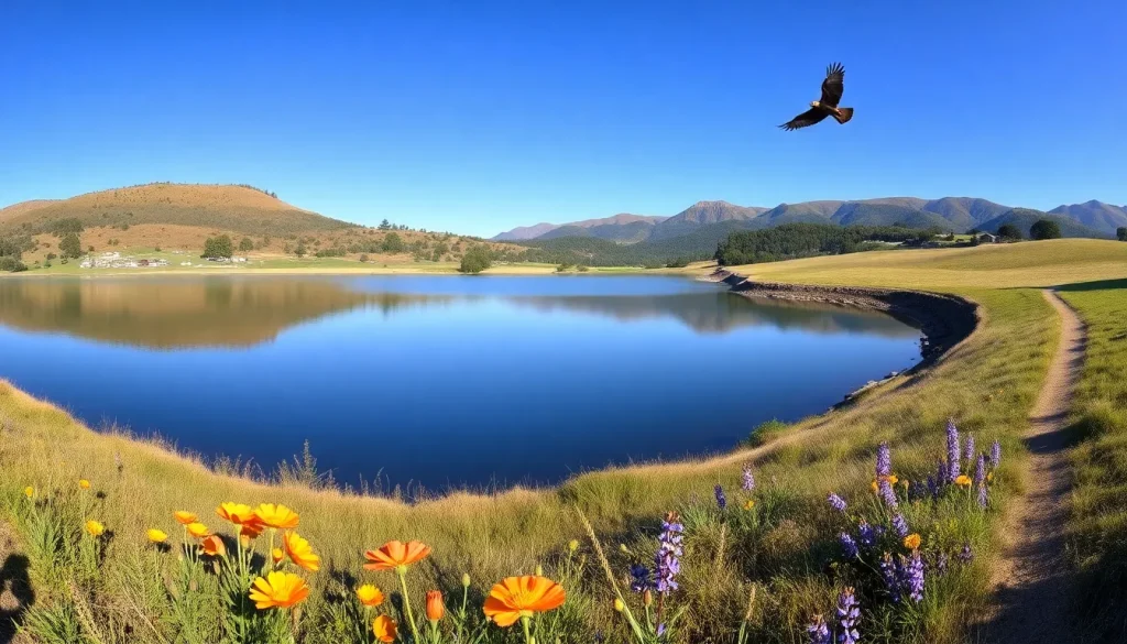
Foothills Nature Preserve, a 1,400-acre expanse of oak woodland, chaparral, and grassland in the Santa Cruz Mountains, offers a tranquil retreat just minutes from the urban core of Palo Alto. Formerly known as Foothills Park, this preserve is a sanctuary for native plants and wildlife, featuring the serene Boronda Lake, over 15 miles of trails, and panoramic views of the San Francisco Bay. Whether you seek a leisurely lakeside stroll, a vigorous ridge hike, or a quiet spot for birdwatching, Foothills Nature Preserve provides a quintessential California landscape shaped by conservation and community stewardship.
Park Overview
Foothills Nature Preserve is a 1,400-acre open space located in the foothills of the Santa Cruz Mountains, owned and operated by the City of Palo Alto. The preserve is characterized by rolling hills, dense oak woodlands, chaparral-covered slopes, and the 10-acre Boronda Lake. It serves as a critical habitat for diverse wildlife, including black-tailed deer, bobcats, coyotes, and over 150 bird species. The park’s trail system connects to the larger Midpeninsula Regional Open Space District network, offering opportunities for extended hikes. Since its opening in 1965, the preserve has been a beloved natural area, and in 2020 it was renamed from Foothills Park to Foothills Nature Preserve to better reflect its ecological mission and to welcome all visitors regardless of residency.
Location and Map
The preserve is situated at 11799 Page Mill Road, Los Altos Hills, CA 94022, approximately 6 miles west of downtown Palo Alto. The main entrance is off Page Mill Road, just past the intersection with Arastradero Road. The preserve lies within the Santa Cruz Mountains, with elevations ranging from 600 to 2,200 feet. Use the interactive map below to orient yourself.
Hours
Foothills Nature Preserve is open daily from 8:00 AM to sunset. The gate is locked at sunset, and all visitors must exit by that time. Hours vary seasonally with daylight; typical closing times are 5:00 PM in winter, 7:00 PM in spring and fall, and 8:30 PM in summer. The preserve is open every day of the year, including holidays, except during extreme weather events or fire danger closures. Always check the official City of Palo Alto Open Space website for current hours and any temporary closures before visiting.
Size
The preserve encompasses 1,400 acres (5.7 km²) of protected open space. It features a diverse topography, from the flat meadows around Boronda Lake to the steep slopes of the Santa Cruz Mountains, with the highest point at 2,200 feet above sea level. The trail network spans over 15 miles, offering routes for all skill levels.
Amenities
Foothills Nature Preserve provides basic amenities to support day-use visits. There is no overnight camping, and facilities are designed to minimize human impact. The following table summarizes key amenities and their availability.
| Amenity | Availability |
|---|---|
| Parking | Multiple lots; main lot at entrance, additional lots near Boronda Lake and Orchard Glen. Total capacity approximately 200 vehicles. |
| Restrooms | Flush toilets and drinking fountains at the Interpretive Center; portable toilets at trailheads. |
| Picnic Areas | Numerous tables and barbecue grills near Boronda Lake and in shaded groves; first-come, first-served. |
| Interpretive Center | Small center with natural history exhibits, open weekends and some weekdays; hours vary. |
| Drinking Water | Available at the Interpretive Center and near the main parking area. |
| Boat Launch | Hand-launch ramp for non-motorized boats on Boronda Lake; no rentals available. |
| Playground | None. |
| Wi-Fi | Not available. |
Accessibility
Foothills Nature Preserve strives to provide access to all visitors. The main parking area and the Interpretive Center are wheelchair accessible, with designated accessible parking spaces and restrooms. A paved, level path leads from the parking lot to the lake and picnic area, approximately 0.3 miles one way, suitable for wheelchairs and strollers. However, most trails are unpaved, narrow, and have steep grades, making them inaccessible to standard wheelchairs. Service animals are permitted on all trails, but pets and emotional support animals are not allowed. Visitors with mobility concerns are encouraged to contact the preserve office in advance for the most current accessibility information.
Trails
The preserve offers over 15 miles of trails ranging from easy lakeside walks to strenuous ridge climbs. All trails are well-marked with signs and trail markers. Bicycles and motorized vehicles are prohibited on all trails. Below are some of the most popular routes.
Los Trancos Trail
Distance: 1.5 miles (loop) | Elevation Gain: 200 feet | Difficulty: Easy. This gentle loop circles Boronda Lake, offering close-up views of waterfowl and access to fishing spots. The trail is mostly flat and partially shaded, with several benches along the way. It connects to the picnic areas and is ideal for families.
Wild Rye Trail
Distance: 1.2 miles (one way) | Elevation Gain: 400 feet | Difficulty: Moderate. Winding through grasslands and oak woodlands, this trail provides excellent wildflower displays in spring. It links the lake area to the higher elevation trails and offers glimpses of the Bay.
Chamise Trail
Distance: 2.0 miles (one way) | Elevation Gain: 800 feet | Difficulty: Strenuous. Named for the dominant chamise shrub, this trail climbs steeply through chaparral to a ridge with sweeping views of the South Bay. It connects to the Bay Area Ridge Trail and is a favorite for experienced hikers.
Stevens Creek Nature Trail
Distance: 3.5 miles (loop) | Elevation Gain: 600 feet | Difficulty: Moderate. This interpretive loop descends into a lush riparian corridor along Stevens Creek, then climbs back through mixed evergreen forest. Interpretive signs explain the area’s ecology and history.
Bay Area Ridge Trail (Segment)
Distance: 2.8 miles (within preserve) | Elevation Gain: 1,000 feet | Difficulty: Strenuous. Part of the regional 550-mile Ridge Trail, this segment traverses the highest ridges of the preserve, offering panoramic vistas from multiple overlooks. It connects to neighboring open space preserves for longer treks.
Natural Features
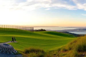
Foothills Nature Preserve protects a mosaic of habitats typical of the inner Coast Range. Oak woodlands dominated by coast live oak, valley oak, and blue oak cover the lower slopes, providing acorns for wildlife. Chaparral communities of chamise, manzanita, and ceanothus thrive on drier, sun-exposed ridges. Riparian corridors along Los Trancos and Stevens creeks support sycamores, willows, and ferns. Boronda Lake, a man-made reservoir, is a focal point for aquatic life and migratory birds. The preserve is home to mammals such as black-tailed deer, bobcat, gray fox, and occasional mountain lion. Birdwatchers can spot red-tailed hawks, acorn woodpeckers, California quail, and great blue herons. Spring brings vibrant wildflower blooms including California poppies, lupines, and checkerblooms.
History
The land now within the preserve was originally inhabited by the Ohlone people, who utilized its resources for thousands of years. In the Mexican era, it became part of Rancho La Purísima Concepción. After American settlement, the area was used for cattle grazing and logging. In the 1950s, Palo Alto residents began advocating for a city-owned park in the foothills. The city acquired the initial 1,200 acres, and Foothills Park opened in 1965. For 55 years, access was restricted to Palo Alto residents and their guests, a policy that faced legal challenges and criticism. In 2020, the City Council voted to open the park to all visitors and renamed it Foothills Nature Preserve to emphasize its conservation purpose. Today, it remains a testament to community-driven land preservation.
Rules and Restrictions
To protect the natural environment and ensure a safe experience, all visitors must adhere to the following regulations:
- No pets allowed anywhere in the preserve, including in vehicles. Service animals are permitted.
- No bicycles or motorized vehicles on trails.
- No swimming or wading in Boronda Lake.
- Fishing is permitted with a valid California fishing license; only barbless hooks may be used.
- Boating is allowed on Boronda Lake for non-motorized, hand-launched craft only; no inflatables or stand-up paddleboards.
- No drones or remote-controlled aircraft.
- No smoking or open fires except in designated barbecue grills.
- Stay on marked trails to prevent erosion and protect habitat.
- Pack out all trash; there are no trash cans on trails.
- Quiet hours are observed; amplified music is prohibited.
Transit and Parking
Foothills Nature Preserve is primarily accessed by private vehicle. There is no direct public transit to the preserve entrance. The nearest VTA bus stop is at Page Mill Road and Arastradero Road (Route 40), approximately 1.5 miles from the gate, with a steep, narrow road lacking sidewalks. Cycling to the preserve is possible but challenging due to the hilly terrain and lack of bike lanes on Page Mill Road. Parking is available in several lots: the main lot near the entrance, the Boronda Lake lot, and the Orchard Glen lot. Total capacity is about 200 spaces. On busy weekends and holidays, lots may fill by late morning; arrive early or visit on weekdays. Parking is free. Overflow parking is not permitted on Page Mill Road; vehicles parked illegally will be cited.
Nearby Places
- Los Trancos Open Space Preserve – Adjacent preserve with the San Andreas Fault Trail and interpretive earthquake exhibits.
- Monte Bello Open Space Preserve – Expansive preserve with ridge-top trails and stunning Bay Area views.
- Pearson-Arastradero Preserve – Palo Alto open space with rolling grasslands and multi-use trails.
- Russian Ridge Open Space Preserve – Known for spectacular spring wildflowers and panoramic vistas.
- Skyline Ridge Open Space Preserve – Features two small lakes and diverse habitats along Skyline Boulevard.
Official Alerts
No active alerts at time of writing. However, visitors should always check for seasonal fire danger closures, especially from June through October. During Red Flag Warnings, the preserve may close on short notice. Trail conditions can be muddy after winter storms. For current alerts, visit the City of Palo Alto Open Space website or call the preserve office at (650) 329-2423.
Last Checked
2025-03-30
FAQ
Is Foothills Nature Preserve open to non-residents?
Yes. Since December 2020, the preserve is open to all visitors regardless of residency. Previously it was restricted to Palo Alto residents and their guests.
Can I bring my dog?
No. Dogs and other pets are not allowed anywhere in the preserve, including in parked vehicles. Only trained service animals are permitted.
Is fishing allowed in Boronda Lake?
Yes, fishing is permitted with a valid California fishing license. Only barbless hooks may be used, and all fishing is catch-and-release for some species. Check current regulations before fishing.
Are there any entrance fees?
No. Entry and parking are free for all visitors.
What is the best time to visit for wildflowers?
Spring, typically March through May, offers the best wildflower displays, especially along the Wild Rye Trail and open grasslands.
Leave a Reply