Short Answer
Introduction
Nestled in the foothills of the Santa Cruz Mountains, Foothills Nature Preserve stands as a 1,400-acre testament to the ecological richness and cultural heritage of the San Francisco Peninsula. Located just minutes from downtown Palo Alto, this protected landscape offers a rare convergence of diverse habitats, a meticulously maintained trail system, and a layered human history that stretches from indigenous stewardship to modern conservation. Originally known as Foothills Park, the preserve was established in 1965 and for decades remained accessible only to Palo Alto residents. A landmark policy change in 2020 opened its gates to all, transforming it into a truly public resource. Today, Foothills Nature Preserve serves as both a recreational haven and a living laboratory, where visitors can explore oak woodlands, chaparral-covered slopes, riparian corridors, and the serene Boronda Lake. This article provides a definitive, encyclopedic overview of the preserve’s landscape, trails, and history, offering actionable insights for visitors, naturalists, and conservationists alike.
Overview
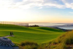
Foothills Nature Preserve is situated in the northeastern Santa Cruz Mountains, within the Los Trancos Creek watershed. The preserve’s topography is characterized by rolling hills, steep canyons, and ridgelines that offer sweeping views of the San Francisco Bay and the Diablo Range. Elevations range from approximately 300 feet near the entrance to over 1,200 feet at the highest points. The landscape is a mosaic of distinct plant communities, including coast live oak woodlands, mixed evergreen forests, chaparral, and annual grasslands. These habitats support a remarkable diversity of wildlife, from black-tailed deer and bobcats to over 150 species of birds. The preserve is also a critical part of a larger network of protected lands, connecting to Pearson-Arastradero Preserve and the Midpeninsula Regional Open Space District’s preserves, forming a vital wildlife corridor.
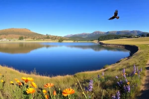
The trail system spans approximately 15 miles, offering routes for hikers, equestrians, and cyclists (on designated paths). The centerpiece is Boronda Lake, a 6-acre reservoir that provides habitat for waterfowl and a scenic destination for visitors. The preserve’s history is equally compelling, tracing back to the Ohlone people, through the Spanish and Mexican land grant eras, to the Boronda family’s ranching operations, and finally to its acquisition by the City of Palo Alto for open space and recreation. Today, the preserve is managed by the Palo Alto Parks and Open Space Division, balancing public access with ecological stewardship.
Key Concepts
Geology and Landscape Formation
The preserve lies within the Santa Cruz Mountains, a range formed by tectonic uplift along the San Andreas Fault, which runs just west of the preserve. The bedrock consists primarily of Franciscan Complex rocks, a jumble of greywacke, shale, and greenstone dating back to the Jurassic and Cretaceous periods. Over millennia, Los Trancos Creek and its tributaries have carved deep valleys, exposing these ancient formations. The preserve’s soils are predominantly well-drained, gravelly loams that support a variety of plant communities. The landscape is a classic example of California’s Mediterranean-type ecosystem, with hot, dry summers and cool, wet winters shaping the vegetation and wildlife patterns.
Flora: A Tapestry of Plant Communities
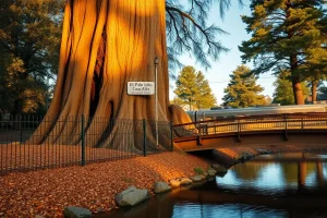
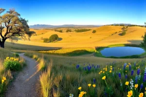
The preserve’s plant life is organized into several distinct communities. Oak woodlands dominate the lower elevations, featuring coast live oak (Quercus agrifolia), valley oak (Quercus lobata), and California bay laurel (Umbellularia californica). The understory includes toyon, poison oak, and native grasses. Chaparral covers the drier, south-facing slopes, with chamise, manzanita, and ceanothus species forming dense, shrubby thickets. Riparian corridors along Los Trancos Creek support willows, cottonwoods, and sycamores, providing critical habitat for amphibians and birds. Grasslands on the preserve’s ridges and meadows are home to native wildflowers such as California poppy, lupine, and owl’s clover, which put on a vibrant display in spring. The preserve also contains several rare and endemic plant species, including the Santa Cruz Mountains manzanita (Arctostaphylos andersonii) and the fragrant fritillary (Fritillaria liliacea), both of which are monitored by conservation staff.
Fauna: Wildlife of the Foothills
The preserve’s varied habitats support a rich array of wildlife. Mammals include black-tailed deer, coyotes, bobcats, grey foxes, and an occasional mountain lion. Smaller mammals such as brush rabbits, California ground squirrels, and dusky-footed woodrats are common. The preserve is a designated Important Bird Area, with over 150 species recorded, including resident and migratory birds. Raptors like red-tailed hawks, Cooper’s hawks, and great horned owls nest in the woodlands, while acorn woodpeckers and western bluebirds are frequently seen in the oak savannas. The riparian zones host Pacific tree frogs, California newts, and western pond turtles. The preserve’s Boronda Lake is stocked with fish and attracts great blue herons and belted kingfishers. Invertebrate life is equally diverse, with numerous butterfly species such as the California sister and the pipevine swallowtail.
Cultural History: From Ohlone to Open Space
Long before European contact, the area was inhabited by the Ohlone people, specifically the Puichon tribelet, who utilized the land for hunting, gathering, and seasonal encampments. Archaeological evidence, including bedrock mortars and shell middens, indicates a sustained presence. The Spanish arrival in the late 18th century led to the establishment of Mission Santa Clara and the displacement of indigenous communities. The land later became part of Rancho San Antonio, a Mexican land grant awarded to Juan Prado Mesa in 1839. In the 1850s, the Boronda family acquired a large portion of the rancho, using the area for cattle grazing and farming. The preserve’s Boronda Lake and Boronda Creek bear their name. In the early 20th century, the land was eyed for development, but a coalition of Palo Alto residents and city officials recognized its ecological and recreational value. The City of Palo Alto purchased the initial 1,200 acres in 1958, with additional acquisitions bringing the preserve to its current size. It opened as Foothills Park in 1965, with a controversial residency restriction that limited access to Palo Alto residents and their guests. This restriction was lifted in 2020 following a lawsuit and changing community values, and the park was renamed Foothills Nature Preserve to reflect its broader public mission.
Benefits
Recreational Opportunities
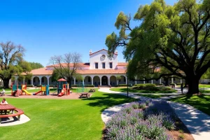
Foothills Nature Preserve offers a wide range of low-impact recreational activities. Hiking is the most popular, with trails ranging from easy lakeside strolls to strenuous ridge climbs. The preserve is also open to equestrians on designated trails, and cyclists on the main paved road and select dirt paths. Picnicking is available at several sites, including the Oak Grove and Boronda Lake areas. The preserve’s interpretive programs, led by rangers and volunteers, provide educational walks on topics such as wildflower identification, birdwatching, and local history. The preserve’s scenic vistas make it a favored spot for photography and nature journaling.
Ecological Services
Beyond recreation, the preserve provides critical ecosystem services. Its forests and soils sequester carbon, helping to mitigate climate change. The watershed of Los Trancos Creek filters rainwater, recharging groundwater and maintaining water quality for downstream communities. The preserve serves as a refuge for native biodiversity, including species that are rare or threatened elsewhere in the region. It also acts as a living laboratory for scientific research, with studies on oak woodland regeneration, invasive species management, and wildlife corridor connectivity.
Community Health and Education
Access to nature has well-documented benefits for mental and physical health. The preserve offers a tranquil escape from urban life, reducing stress and promoting physical activity. Its educational programs foster environmental literacy and a sense of stewardship among visitors of all ages. The preserve’s inclusive access policy, adopted in 2020, ensures that these benefits are available to a diverse cross-section of the Bay Area population.
Challenges
Invasive Species Management
Like many California open spaces, Foothills Nature Preserve faces significant pressure from non-native plants. French broom (Genista monspessulana), yellow star-thistle (Centaurea solstitialis), and Harding grass (Phalaris aquatica) are among the most aggressive invaders, outcompeting native flora and altering fire regimes. The preserve’s management team conducts regular removal efforts, including mechanical clearing and targeted herbicide application, but eradication is an ongoing challenge requiring sustained funding and volunteer support.
Wildfire Risk
The preserve’s chaparral and woodland habitats are fire-adapted, but decades of fire suppression have led to unnatural fuel accumulation. Combined with climate change-driven drought, the risk of catastrophic wildfire is a constant concern. The City of Palo Alto has implemented fuel reduction projects, including shaded fuel breaks and prescribed burns in collaboration with Cal Fire. However, balancing fire safety with ecological health and public access remains a complex management issue.
Visitor Impact and Trail Sustainability
Since the preserve opened to the general public in 2020, visitation has increased significantly, with annual estimates exceeding 200,000 visitors. This surge has led to trail erosion, soil compaction, and disturbance to wildlife. Parking capacity is limited, and overflow on peak days creates congestion on Page Mill Road. Managers are working to improve trail design, install erosion-control structures, and promote responsible use through education and enforcement.
Best Practices
Trail Etiquette and Safety
Visitors are encouraged to follow Leave No Trace principles. Stay on designated trails to protect sensitive habitats and prevent erosion. Yield to equestrians and uphill hikers. Dogs are not permitted in the preserve to protect wildlife. Mountain bikes are allowed only on paved roads and specific dirt trails; check the trail map for designations. Be aware of poison oak, which is abundant along many trails, and check for ticks after your visit. During hot summer months, carry ample water and avoid hiking during peak heat.
Wildlife Viewing Guidelines
Observe wildlife from a distance; never feed or approach animals. If you encounter a mountain lion, make yourself appear large, maintain eye contact, and back away slowly. Do not run. Report any sightings to preserve staff. Nesting birds and newborn fawns are particularly vulnerable; keep dogs at home and stay on trails to minimize disturbance.
Supporting Conservation
Visitors can contribute to the preserve’s health by volunteering for habitat restoration workdays, participating in citizen science projects like bird counts, and donating to the Palo Alto Parks and Open Space Foundation. Reporting invasive plant sightings or trail issues to rangers helps management respond quickly.
Tools & Resources
Maps and Navigation
Official trail maps are available at the entrance kiosk and online through the City of Palo Alto website. The free OuterSpatial app provides interactive maps, trail conditions, and points of interest. For offline navigation, download the preserve’s map from Avenza Maps. Key trailheads include the main parking area near the interpretive center, the Oak Grove picnic area, and the Los Trancos Trailhead.
Visitor Facilities
The preserve features restrooms, drinking fountains, and picnic tables at several locations. The Interpretive Center, open on weekends, offers exhibits on local ecology and history, as well as a small library of field guides. There is no food service; visitors should bring their own supplies. Cell phone reception is limited in many areas of the preserve.
Educational Programs and Guided Hikes
The City of Palo Alto’s Open Space Division offers a calendar of free, ranger-led hikes and workshops. Topics range from wildflower walks in spring to astronomy nights. Local organizations such as the Santa Clara Valley Audubon Society and the California Native Plant Society also lead outings in the preserve. Check the city’s website for current schedules and registration details.
Future Trends
Climate Adaptation and Resilience
As the region faces hotter, drier conditions, the preserve’s management is prioritizing climate adaptation. This includes restoring native grasslands that are more drought-tolerant, enhancing riparian buffers to protect water resources, and experimenting with assisted migration of certain plant species. The preserve is also part of a regional network monitoring the impacts of climate change on biodiversity.
Expanded Access and Equity
The 2020 opening of the preserve to all visitors was a pivotal step toward equity. Future plans include improved public transit access, multilingual interpretive signage, and partnerships with community organizations to welcome underrepresented groups. The city is exploring a shuttle service from Palo Alto transit hubs to reduce vehicle congestion and emissions.
Restoration and Connectivity Projects
Several large-scale restoration projects are in the planning stages. These include the removal of invasive eucalyptus groves near the entrance, the restoration of a former ranch pond to enhance amphibian habitat, and the creation of a new segment of the Bay Area Ridge Trail that would connect the preserve to neighboring open spaces. These efforts aim to bolster ecological connectivity and provide new recreational opportunities.
Conclusion
Foothills Nature Preserve is far more than a scenic backdrop; it is a dynamic landscape where geology, ecology, and human history intertwine. From the ancient rocks of the Franciscan Complex to the vibrant wildflower displays of spring, from the Ohlone’s first footsteps to the modern hiker’s trek, the preserve tells a story of resilience and connection. As it navigates the challenges of the 21st century—climate change, increased visitation, and the ongoing work of ecological restoration—the preserve stands as a model for how urban-adjacent open spaces can balance conservation with public enjoyment. Whether you come for the trails, the wildlife, or the quiet contemplation of Boronda Lake, Foothills Nature Preserve offers a profound encounter with the natural world, right in the heart of Silicon Valley.
| Fact | Detail |
|---|---|
| Total Area | 1,400 acres (5.7 km²) |
| Year Established | 1965 (opened to all in 2020) |
| Trail Network | Approximately 15 miles (24 km) |
| Highest Elevation | ~1,200 feet (366 m) |
| Key Water Feature | Boronda Lake (6 acres) |
| Dominant Habitats | Oak woodland, chaparral, grassland, riparian |
| Bird Species Recorded | Over 150 |
| Annual Visitation (2023 est.) | ~220,000 |
| Managed By | City of Palo Alto Parks and Open Space Division |
| Public Access | Daily, 8 a.m. to sunset; no dogs allowed |
FAQ
Is Foothills Nature Preserve open to non-residents?
Yes, since 2020 the preserve is open to all visitors regardless of residency.
What recreational activities are allowed?
Hiking, cycling on designated paths, horseback riding on designated trails, picnicking, and nature study.
What is the history of the preserve?
The land was originally inhabited by the Ohlone people, later part of Rancho San Antonio, then ranched by the Boronda family. The City of Palo Alto acquired it in 1958 and opened it as Foothills Park in 1965, later renamed Foothills Nature Preserve.
What wildlife can be seen?
Common sightings include black-tailed deer, coyotes, bobcats, grey foxes, and over 150 bird species such as red-tailed hawks, acorn woodpeckers, and great blue herons.
What are the main plant communities?
Coast live oak woodlands, chaparral, riparian corridors along creeks, and annual grasslands with native wildflowers.
Leave a Reply