Short Answer
One-Sentence Summary
The annexation of Mayfield by Palo Alto on July 6, 1925, extinguished a boisterous, working-class railroad town whose identity was forged by the Southern Pacific, Stanford University’s temperance policies, and a defiant saloon culture, yet its bones remain visible in the street pattern and commercial life of today’s California Avenue district.
Key Dates
| Date | Event |
|---|---|
| 1855 | First permanent settlement established near present-day California Avenue; area known as Mayfield after landowner John Mayfield. |
| 1863 | Southern Pacific Railroad completes line through Mayfield, making it a key shipping point for grain and livestock. |
| 1891 | Stanford University opens; its charter and Palo Alto’s early ordinances prohibit alcohol sales, driving thirsty students and workers to Mayfield’s saloons. |
| 1903 | Mayfield incorporates as a town, electing its first board of trustees and formalizing its independence from county governance. |
| 1913 | First serious annexation proposal by Palo Alto fails after fierce opposition from Mayfield saloonkeepers and residents. |
| 1924 | Palo Alto launches a renewed annexation campaign, citing water infrastructure needs and the desire to close the “Whiskey Gulch” vice district. |
| June 1925 | Annexation election held; Mayfield voters narrowly approve consolidation, 312 to 287. |
| July 6, 1925 | Official annexation takes effect; Mayfield’s town government dissolves, and its saloons are ordered closed within one year. |
| 1926 | Last of the original Mayfield saloons shutters; California Avenue begins its transformation into a neighborhood shopping street. |
| 1970s | Historic preservation efforts document surviving Mayfield structures; the “Mayfield” name is revived for a new community center and park. |
Geographic Setting
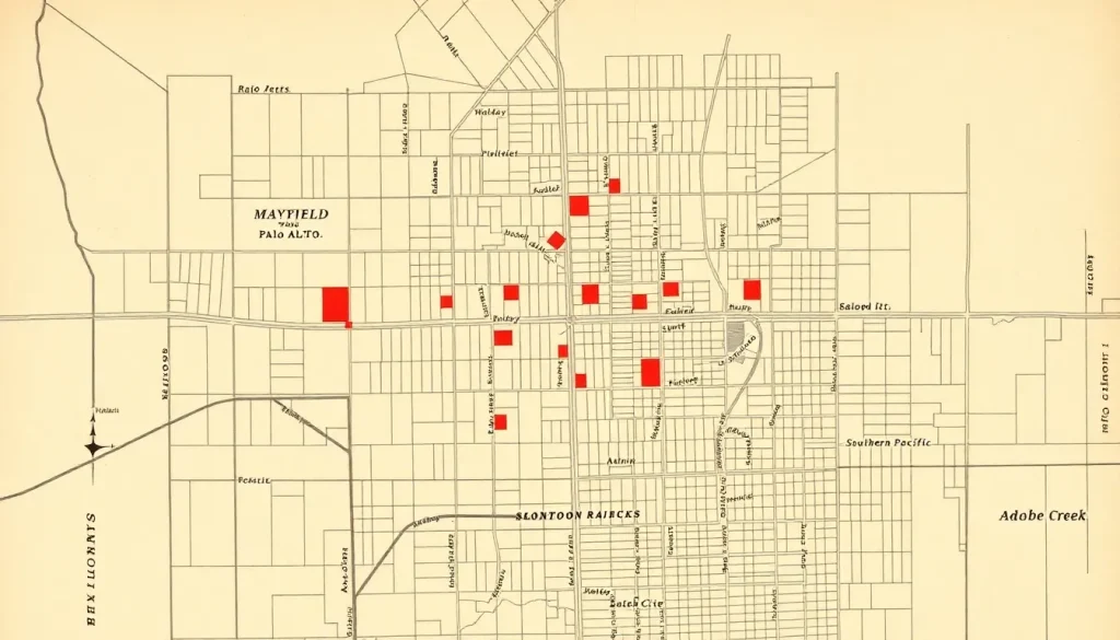
The original Mayfield townsite occupied a flat, fertile plain between the San Francisquito Creek watershed and the foothills of the Santa Cruz Mountains, roughly two miles south of the fledgling Palo Alto. Its core lay along the Southern Pacific tracks, with the depot and freight yards anchoring a grid of small lots that stretched from present-day California Avenue south to Lambert Avenue, and from El Camino Real west to the railroad right-of-way. Adobe Creek meandered along the town’s western edge, providing water for early farms but also creating seasonal flood hazards. What was once open grain fields and orchards is now a dense, walkable commercial district; the original creek bed was channelized and now runs beneath a storm drain under Birch Street. Modern visitors can orient themselves by standing at the intersection of California Avenue and Ash Street—the heart of old Mayfield—where the 1908 Sanborn map shows a cluster of saloons, a livery stable, and the two-story Mayfield Hotel.
Origins
The settlement that became Mayfield emerged in the mid-1850s as a stagecoach stop on the rough road between San Jose and San Francisco. The exact date of the first permanent structure is disputed, with some sources claiming a way station existed as early as 1853, but the earliest recorded land claim belongs to John Mayfield, a Tennessee-born rancher who acquired a large tract in 1855 and gave the community its name. Indigenous history in the area is deeper still: the region was part of the ancestral territory of the Muwekma Ohlone people, and archaeological evidence suggests seasonal encampments along Adobe Creek for millennia before Spanish contact. The arrival of the Southern Pacific Railroad in 1863 transformed the sleepy crossroads into a bustling agricultural shipping point. Grain, hay, and later fruit from surrounding orchards were loaded onto freight cars, and a small commercial core of blacksmiths, general stores, and boarding houses grew up around the depot. The railroad also brought a transient workforce, laying the social foundation for the saloon culture that would later define the town.
Growth and Community Life
At its peak between 1890 and 1915, Mayfield was a town of roughly 1,800 to 2,200 souls, with a character sharply distinct from its neighbor to the north. Contemporary newspaper accounts reported that the Fourth of July celebration of 1892 drew over 2,000 people for horse races, baseball games, and a “grand display of fireworks” paid for by saloon subscriptions. The town boasted two churches (Methodist and Catholic), a two-room schoolhouse, a volunteer fire brigade, and at least fourteen licensed saloons along what is now California Avenue—earning it the enduring nickname “Whiskey Gulch.” The 1900 census reveals a predominantly white, working-class population of railroad laborers, teamsters, small farmers, and Irish and German immigrants, with a small Chinese community that operated laundries and market gardens on the town’s margins. Social life revolved around the fraternal lodges (the Odd Fellows hall still stands, repurposed), the baseball team, and the constant tension between the temperance-minded churchgoers and the saloonkeepers who dominated the town board. A 1905 diary entry from a local schoolteacher laments that “the sound of fistfights outside the saloons drifts through the classroom windows on hot afternoons.”
Relationship with Nearby Powers
Mayfield’s fate was inextricably bound to two larger forces: Stanford University and the city of Palo Alto. When Leland Stanford founded his university in 1891, he imposed a strict alcohol prohibition on campus and within the surrounding Palo Alto townsite, which he controlled. Palo Alto’s early trustees, many with Stanford ties, extended the dry zone. This created an immediate economic boom for Mayfield, located just outside the prohibition boundary. Students, faculty, and construction workers flocked to Mayfield’s saloons, and the town became a notorious “vice district” in the eyes of university administrators. The relationship was one of mutual dependency and mutual contempt: Mayfield needed Stanford’s money, but resented the moralizing; Palo Alto and Stanford viewed Mayfield as a corrupting influence and a barrier to orderly expansion. Political maneuvering intensified after Palo Alto’s incorporation in 1894. Palo Alto sought to control the entire urbanizing corridor, and Mayfield’s saloon tax base was both a prize and a scandal. Multiple annexation attempts were rebuffed by Mayfield voters who feared the loss of their liquor licenses and their town’s rough-hewn autonomy. As one anti-annexation broadside from 1913 put it, “Palo Alto wants our taxes but not our people.”
Annexation, Decline, or Transformation
The final push for annexation came in the early 1920s, driven by Palo Alto’s need for a reliable water supply and the growing national temperance movement that culminated in Prohibition. With saloons already weakened by the 18th Amendment, Mayfield’s economic rationale for independence crumbled. Palo Alto leaders, including prominent attorney and future judge Frank H. Kerrigan, framed annexation as a progressive reform that would bring paved streets, sewers, and better schools to the neglected town. According to the city inventory, the annexation agreement was signed on July 6, 1925, after a bitterly contested election on June 23. The vote was 312 in favor and 287 against—a margin of only 25 votes. Oral histories collected in the 1930s indicate that many “yes” voters were newer residents who had moved to Mayfield for its cheap housing and cared little for its saloon heritage. The final meeting of the Mayfield Board of Trustees was held in a back room of the Bank of Mayfield building because the town hall had already been sold to a private buyer. Within a year, all remaining saloons were shuttered, and the town’s identity was systematically absorbed: street names were changed (Mayfield’s Main Street became California Avenue), the police force was disbanded, and the old town records were transferred to Palo Alto’s basement archives, where they remained largely uncatalogued for decades.
What Remains Today
A careful observer can still trace the ghost of Mayfield in the California Avenue district. The current building at 315 California Avenue, now a restaurant, should not be confused with the original Mayfield Hotel, which burned in 1912; however, its foundation stones were reused in the adjacent commercial structure at 325 California. The 1904 Odd Fellows Hall at 350 California Avenue survives with its original façade largely intact, now housing retail shops. The street grid south of California Avenue—with its narrow lots and irregular alleys—preserves the pre-annexation platting, a sharp contrast to the more spacious lots of northern Palo Alto. A small bronze plaque on the corner of California and Ash, installed by the Palo Alto Historical Association in 1976, marks the site of the town’s first saloon. The Mayfield name itself was resurrected in the 1970s with the construction of the Mayfield Community Center and Mayfield Park on the site of the old schoolhouse. The original Mayfield depot was demolished in the 1950s, but a Caltrain station still operates at the same location, and the adjacent right-of-way remains a defining edge. No known photographs of the original town hall survive, but a 1908 Sanborn fire insurance map, held at the Palo Alto City Archives, shows its exact footprint at 375 California Avenue, now a parking lot.
Historical Photographs and Maps
Three visual sources are essential for understanding Mayfield’s lost landscape. First, the 1908 Sanborn fire insurance map, available digitally through the Library of Congress, depicts every structure in the commercial core, color-coded by building material, and reveals the dense concentration of saloons labeled “SAL.” with notations like “whiskey stored in cellar.” Second, a panoramic photograph taken from the Stanford water tower in 1904, held in the Stanford University Archives, captures Mayfield as a cluster of low wooden buildings surrounded by orchards, with the railroad tracks cutting a sharp diagonal across the frame. Third, a series of informal snapshots taken by a Mayfield resident named Arthur Lindgren between 1915 and 1925, now in the possession of the Palo Alto Historical Association, document the interiors of several saloons, the volunteer fire brigade posing with their hand-pumped engine, and the last Mayfield Board of Trustees seated around a battered oak table. These images collectively challenge the booster narrative of a lawless backwater, showing instead a community with its own institutions, pride, and visual culture.
Historiographical Notes
The story of Mayfield’s annexation has been told almost exclusively from the perspective of the victors. Early Palo Alto histories, such as Orrin Leslie Elliott’s 1937 Stanford University and the Community, frame the annexation as a triumph of civic improvement over vice and disorder, downplaying the economic coercion and cultural erasure involved. The saloonkeepers are caricatured as corrupt machine politicians, while the temperance activists are portrayed as disinterested reformers. More recent revisionist work, particularly the 1995 master’s thesis by local historian Margaret Connors, “Whiskey Gulch: The Social World of a Railroad Saloon Town,” uses oral histories and liquor license records to reconstruct the saloon as a working-class social center, not merely a den of iniquity. The official records of the annexation proceedings, held by the Santa Clara County Board of Supervisors, contain affidavits from Mayfield residents alleging voter intimidation and ballot irregularities, but these complaints were never formally investigated. The silence in the archival record regarding the town’s Chinese community is especially stark; census data confirms their presence, but no known oral histories or personal papers survive, a gap that future researchers must acknowledge.
Sources and Archives
The most important repository for Mayfield material is the Palo Alto Historical Association, which holds the Mayfield Annexation Files (1924–1925), a collection of campaign flyers, newspaper clippings, and the original tally sheets from the 1925 election. The Santa Clara County Archives in San Jose preserves the official annexation ordinance and related Board of Supervisors minutes. Stanford University’s Special Collections houses the Leland Stanford Papers, which contain correspondence between university officials and Palo Alto leaders strategizing the annexation as early as 1908. The California State Library’s microfilm collection includes the complete run of the Mayfield Enterprise, the town’s short-lived weekly newspaper (1901–1906), which provides a rare, unfiltered local voice. Oral histories collected by the Works Progress Administration in the 1930s, now at the Bancroft Library, include interviews with several former Mayfield residents, though their reliability is uneven. The Sanborn maps for 1908 and 1923 are accessible online through the Library of Congress.
Related People and Places
John F. Parkinson (1868–1941): The last mayor of Mayfield, a saloonkeeper and livery stable owner who led the anti-annexation fight. His personal papers, including a handwritten speech urging residents to “vote for your town’s life,” are held by his descendants in San Jose.
Frank H. Kerrigan (1878–1952): Palo Alto city attorney and chief architect of the annexation campaign. He later served as a Superior Court judge and wrote a privately printed memoir that glosses over the political hardball tactics used to secure the 1925 vote.
Margaret Connors (b. 1952): Local historian whose 1995 thesis remains the only book-length study of Mayfield’s social history. Her work recovered the voices of saloon patrons and Chinese laundry workers previously ignored.
Whiskey Gulch: The colloquial name for the California Avenue saloon district, now a term of nostalgic affection used by local businesses. A 2015 craft cocktail bar at 340 California Avenue adopted the name as a deliberate historical homage.
College Terrace: A Palo Alto neighborhood developed in the 1890s on land directly adjacent to Mayfield, intended as a dry, middle-class alternative. Its residents were among the most vocal supporters of annexation, viewing Mayfield as a threat to property values.
Stanford University’s “Dry Zone”: The prohibition on alcohol sales within a one-mile radius of the campus, which remained in effect until 1971 and was the single most important factor in Mayfield’s economic rise and eventual absorption.
FAQ
Why was Mayfield annexed by Palo Alto?
Palo Alto sought Mayfield’s tax base, water infrastructure, and land for expansion, while also wanting to eliminate the saloon district that it viewed as a moral blight. Prohibition had weakened the saloon economy, making annexation more politically feasible.
What happened to the saloons after annexation?
All saloons were ordered to close within one year of the July 1925 annexation. Most shut down immediately or converted to other businesses; the last one closed in 1926. The California Avenue district gradually transformed into a family-oriented shopping street.
Can you still see remnants of Mayfield today?
Yes. The street grid south of California Avenue retains its original narrow lots. The 1904 Odd Fellows Hall still stands at 350 California Avenue. A bronze plaque at California and Ash marks the first saloon site, and the Mayfield Community Center and Park preserve the name.
Was the annexation vote fair?
Contemporary accounts and later oral histories suggest irregularities, including allegations of voter intimidation and ballot manipulation. The official result was 312 to 287, but these complaints were never formally investigated, and the narrow margin has fueled historical debate.


Leave a Reply