
Short Answer
Introduction
Palo Alto, California, is globally recognized as a hub of innovation and technology, yet its true natural wealth lies in an extraordinary network of parks and open spaces that harbor a surprising diversity of wildlife. Stretching from the tidal marshes of San Francisco Bay to the chaparral-clad slopes of the Santa Cruz Mountains, these protected lands form a vital ecological corridor in one of the most urbanized regions in the United States. The city’s commitment to preserving over 4,000 acres of open space has created a living mosaic where black-tailed deer graze in grasslands, great egrets stalk the shallows of salt ponds, and the occasional mountain lion roams the forested ridges. This article serves as a definitive, encyclopedic resource on the wildlife of Palo Alto’s parks and open spaces, offering detailed insights into the species, habitats, ecological benefits, challenges, and best practices for stewardship. Whether you are a resident, a visitor, or a student of urban ecology, this guide provides the knowledge needed to appreciate and protect the natural heritage that thrives just minutes from Silicon Valley’s bustling streets.
Overview of Palo Alto’s Parks and Open Spaces
Geography and Ecological Significance
Palo Alto occupies a unique geographical position on the San Francisco Peninsula, bounded by the Bay to the east and the Santa Cruz Mountains to the west. This topographical gradient—from sea level to over 2,000 feet in elevation—creates a remarkable compression of ecological zones within a relatively small area. The city’s open spaces are not isolated islands but part of a larger regional network that includes the Midpeninsula Regional Open Space District preserves, Stanford University lands, and San Mateo County parks. Together, they sustain a critical wildlife corridor that allows species to move between the Diablo Range and the Santa Cruz Mountains, maintaining genetic diversity and ecosystem resilience.
The ecological significance of Palo Alto’s open spaces is amplified by their location along the Pacific Flyway, a major migratory route for birds traveling between Alaska and South America. The Baylands Nature Preserve, in particular, is recognized as a site of hemispheric importance for shorebirds and waterfowl. According to the Santa Clara Valley Audubon Society, over 280 bird species have been recorded in the Baylands alone, making it one of the premier birdwatching destinations in California. The upland preserves, such as Foothills Park and Pearson-Arastradero Preserve, protect remnants of native grasslands, oak woodlands, and riparian forests that once covered the entire region.
Key Protected Areas
Palo Alto’s open space system comprises several distinct units, each with its own ecological character and wildlife communities:
- Baylands Nature Preserve: Encompassing 1,940 acres of tidal and seasonal wetlands, salt ponds, and sloughs, the Baylands is the largest tract of undisturbed marshland in San Francisco Bay. It provides critical habitat for endangered species such as the Ridgway’s rail and the salt marsh harvest mouse, as well as vast numbers of migratory birds.
- Foothills Park (now Foothills Nature Preserve): This 1,400-acre preserve in the Santa Cruz Mountains features dense oak and bay forests, chaparral, and meadows. It is home to large mammals like black-tailed deer, coyotes, bobcats, and occasionally mountain lions. The park’s six miles of trails offer views of the Bay and access to diverse habitats.
- Pearson-Arastradero Preserve: A 622-acre expanse of rolling grasslands, oak savannas, and riparian corridors along Arastradero Creek. This preserve is a stronghold for ground-nesting birds, western bluebirds, and a variety of raptors. It also supports a healthy population of California ground squirrels and their predators.
- Stanford Dish Area: While primarily a Stanford University research facility, the surrounding open space is a prominent landmark and habitat for grassland species, including the threatened California tiger salamander and the western burrowing owl.
- Smaller Neighborhood Parks and Creeks: Parks like Rinconada, Mitchell, and El Palo Alto Park, along with the city’s network of creeks (San Francisquito, Matadero, and Adobe), serve as vital stepping stones for wildlife moving through the urban matrix. These green corridors support raccoons, opossums, songbirds, and pollinators.
Key Concepts in Local Wildlife Ecology
Habitat Types and Their Inhabitants
The diversity of wildlife in Palo Alto is a direct reflection of the variety of habitats found within its open spaces. Understanding these habitats is essential to appreciating the species that depend on them. The following table summarizes the primary habitat types, their characteristics, and representative wildlife.
| Habitat Type | Key Characteristics | Representative Wildlife |
|---|---|---|
| Tidal Salt Marsh | Low elevation, saline soils, cordgrass, pickleweed; daily tidal inundation | Ridgway’s rail, salt marsh harvest mouse, long-billed curlew, snowy egret |
| Freshwater Wetland and Pond | Standing or slow-moving fresh water, cattails, bulrushes, willows | Red-winged blackbird, Pacific tree frog, western pond turtle, great blue heron |
| Coastal Grassland | Open, rolling hills with native perennial bunchgrasses and wildflowers; often invaded by non-native annuals | Western meadowlark, American kestrel, California ground squirrel, gopher snake |
| Oak Woodland and Savanna | Dominated by coast live oak and valley oak, with an understory of grasses and shrubs | Acorn woodpecker, western gray squirrel, mule deer, wild turkey, coyote |
| Mixed Evergreen Forest | Moist, shaded canyons with coast live oak, California bay, madrone, and Douglas-fir | Steller’s jay, dark-eyed junco, bobcat, gray fox, mountain lion (transient) |
| Chaparral | Dense, drought-adapted shrubs like chamise, manzanita, and ceanothus on steep, rocky slopes | California quail, wrentit, brush rabbit, rattlesnake, Anna’s hummingbird |
| Riparian Corridor | Linear bands of trees and shrubs along creeks, including sycamore, willow, and cottonwood | Belted kingfisher, black phoebe, raccoon, monarch butterfly, various bat species |
Indicator and Keystone Species
Certain species serve as barometers of ecosystem health or play disproportionately large roles in maintaining ecological balance. In Palo Alto’s open spaces, the presence of apex predators like the mountain lion (Puma concolor) indicates a functioning food web and sufficient habitat connectivity. Although mountain lions are rarely seen, their occasional presence in Foothills Park and the surrounding wildlands confirms that the landscape can support large carnivores. Similarly, the Ridgway’s rail (Rallus obsoletus) is an indicator of tidal marsh integrity; its population trends reflect the success of wetland restoration efforts.
Keystone species include the California ground squirrel (Otospermophilus beecheyi), whose burrows provide shelter for burrowing owls, tiger salamanders, and numerous invertebrates. The coast live oak (Quercus agrifolia) is a foundational plant species, producing acorns that sustain dozens of animal species and hosting a rich community of insects that in turn feed birds and bats. The acorn woodpecker (Melanerpes formicivorus) is another keystone, creating granary trees that become hubs of activity for many other cavity-nesting species.
Benefits of Urban Wildlife and Open Spaces
Ecosystem Services
Palo Alto’s open spaces deliver a suite of ecosystem services that directly benefit human well-being. The Baylands wetlands act as a natural sponge, absorbing storm surges and reducing flood risk to adjacent neighborhoods and infrastructure. Research by the U.S. Geological Survey has shown that every acre of tidal marsh can provide thousands of dollars in flood protection value annually. The extensive tree canopy in parks and along creeks sequesters carbon dioxide, filters air pollutants, and mitigates the urban heat island effect, lowering local temperatures by as much as 5–10°F during heat waves.
Pollination services provided by native bees, butterflies, and hummingbirds are essential for the reproduction of wild plants and nearby agricultural lands. The open spaces also serve as a genetic reservoir for native plant species, many of which are used in restoration projects across the region. Additionally, the wetlands improve water quality by trapping sediments and absorbing excess nutrients before they reach the Bay.
Recreation and Human Well-being
Access to nature is a cornerstone of public health. Studies consistently demonstrate that time spent in natural settings reduces stress, improves cognitive function, and enhances overall mental health. Palo Alto’s extensive trail network—over 30 miles of paths winding through diverse landscapes—offers residents and visitors opportunities for hiking, birdwatching, photography, and quiet contemplation. The Baylands alone attracts more than 200,000 visitors annually, according to city estimates, making it one of the most popular outdoor destinations on the Peninsula.
Wildlife observation is a particularly powerful form of nature engagement. The simple act of watching a great blue heron stalk prey or hearing the call of a coyote at dusk fosters a sense of connection to the natural world that is increasingly rare in urban environments. This connection has been linked to pro-environmental behaviors and a greater willingness to support conservation initiatives.
Educational Opportunities
Palo Alto’s open spaces function as living classrooms for students of all ages. The Environmental Volunteers organization, based at the EcoCenter in the Baylands, provides hands-on science education to thousands of schoolchildren each year. Programs focus on ecology, climate change, and stewardship, using the surrounding wetlands as a teaching laboratory. Stanford University researchers also utilize the preserves for long-term ecological studies, contributing to the scientific understanding of urban wildlife dynamics.
Challenges Facing Wildlife in Palo Alto
Habitat Fragmentation and Urban Encroachment
Despite the city’s conservation efforts, habitat fragmentation remains a persistent threat. Major roadways such as Highway 101 and Interstate 280 sever wildlife corridors, leading to vehicle collisions and genetic isolation. A 2022 study by the Midpeninsula Regional Open Space District documented over 50 wildlife-vehicle collisions annually on Page Mill Road and Arastradero Road alone, involving deer, coyotes, and smaller mammals. The pressure of adjacent residential development also brings increased light, noise, and domestic animal presence, all of which disrupt wildlife behavior.
Invasive Species
Non-native plants and animals pose a significant challenge to the ecological integrity of Palo Alto’s open spaces. In the Baylands, invasive smooth cordgrass (Spartina alterniflora) hybridizes with native cordgrass, altering marsh structure and reducing habitat quality for rails and other species. In upland areas, yellow starthistle (Centaurea solstitialis) and French broom (Genista monspessulana) outcompete native plants, diminishing forage for wildlife. Invasive animals such as the red fox (Vulpes vulpes) and feral cats prey on native birds and small mammals, while bullfrogs (Lithobates catesbeianus) decimate populations of native amphibians in ponds and creeks.
Human-Wildlife Conflict
As the urban-wildland interface expands, encounters between humans and wildlife become more frequent. Coyotes are increasingly seen in residential neighborhoods, where they may prey on unattended pets. In 2023, the City of Palo Alto received over 100 reports of coyote sightings, a 30% increase from the previous year. Black-tailed deer browse on landscaping, and raccoons raid garbage bins. These conflicts often stem from human behaviors, such as leaving pet food outdoors or failing to secure trash. Education and proactive management are essential to reducing negative interactions while allowing wildlife to thrive.
Climate Change Impacts
Climate change is altering the ecological baseline of the region. Sea-level rise threatens to inundate large portions of the Baylands marsh by 2100, with projections from the California Ocean Protection Council indicating up to 1.9 feet of rise by 2050 under high-emission scenarios. This would drastically reduce intertidal habitat for shorebirds and endangered species. In the foothills, prolonged droughts stress oak trees and increase the risk of catastrophic wildfire, which can destroy habitat and fragment populations. Shifts in temperature and precipitation patterns are also affecting the timing of plant flowering and insect emergence, potentially disrupting food webs.
Best Practices for Coexisting with Wildlife
Responsible Recreation
Visitors to Palo Alto’s parks and open spaces can minimize their impact by following a few key guidelines. Stay on designated trails to avoid trampling sensitive vegetation and disturbing ground-nesting birds. Keep dogs on leash at all times—even well-behaved dogs can frighten wildlife and transmit diseases. Observe wildlife from a distance; use binoculars or a telephoto lens rather than approaching animals. Never feed wildlife, as human food can cause health problems and lead to habituation. The City of Palo Alto’s “Keep Wildlife Wild” campaign emphasizes that a fed animal is a dead animal, as habituated individuals often must be euthanized for public safety.
Wildlife-Safe Gardening
Residents living adjacent to open spaces can create wildlife-friendly gardens that also reduce conflict. Plant native species such as California lilac (Ceanothus), toyon (Heteromeles arbutifolia), and coffeeberry (Frangula californica) to provide natural food and shelter for birds and pollinators. Avoid using rodenticides and pesticides, which can poison predators like hawks and owls. Secure garbage and compost bins with wildlife-resistant lids. Remove fallen fruit from trees and bring pet food indoors at night. Installing motion-activated lights or sprinklers can deter curious coyotes and raccoons without harming them.
Reporting and Monitoring
Community members play a vital role in wildlife conservation by reporting observations. The City of Palo Alto encourages residents to report coyote sightings through its online portal, which helps biologists track movement patterns and identify potential conflict hotspots. Injured or orphaned wildlife should be reported to the Wildlife Center of Silicon Valley, a licensed rehabilitation facility. For rare or dangerous species like mountain lions, immediate notification to the California Department of Fish and Wildlife is recommended. Participating in community science projects, such as the annual Christmas Bird Count or iNaturalist bioblitzes, contributes valuable data to long-term monitoring efforts.
Tools & Resources for Wildlife Enthusiasts
Field Guides and Mobile Apps
Modern technology has made wildlife identification more accessible than ever. The following tools are particularly useful for exploring Palo Alto’s open spaces:
- iNaturalist: A free app that allows users to photograph and identify plants and animals, while contributing to a global biodiversity database. The Palo Alto Baylands and Foothills Park have active iNaturalist projects with thousands of observations.
- Merlin Bird ID: Developed by the Cornell Lab of Ornithology, this app identifies birds by sight or sound and is indispensable for birdwatchers in the Baylands.
- eBird: A platform for recording bird sightings, providing real-time data on species distribution and abundance. Hotspots like the Baylands and Arastradero Preserve are well-covered.
- Sibley Guide to Birds and Peterson Field Guide to Mammals remain classic printed references for in-depth study.
Local Organizations and Volunteer Opportunities
Several organizations are deeply involved in the stewardship of Palo Alto’s open spaces and offer volunteer opportunities:
- Grassroots Ecology: A nonprofit that leads habitat restoration projects, including invasive plant removal and native planting, at Arastradero Preserve and along local creeks.
- Santa Clara Valley Audubon Society: Offers guided bird walks, educational programs, and advocacy for bird conservation.
- Acterra: Focuses on climate resilience and ecological restoration, with volunteer events in the Baylands and foothills.
- City of Palo Alto Open Space Division: Hosts community workdays and provides interpretive signage and maps.
Recommended Trails and Viewing Areas
For optimal wildlife viewing, consider these locations and times:
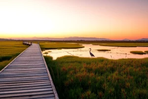
- Baylands: Lucy Evans Boardwalk and the Duck Pond Loop – best at high tide for shorebirds and during winter for migratory ducks.
- Foothills Park: Los Trancos Trail – early morning for deer and coyote sightings; listen for woodpeckers in the oaks.
- Pearson-Arastradero: Arastradero Creek Trail – spring for wildflowers and butterflies; raptors often soar overhead.
- San Francisquito Creek Trail – a shaded corridor where belted kingfishers and black phoebes are common year-round.
Future Trends in Palo Alto’s Open Space Management
Climate Resilience Planning
In response to sea-level rise, the City of Palo Alto and partner agencies are implementing the Baylands Sea Level Rise Adaptation Strategy, which includes enhancing natural marsh accretion, creating transitional upland buffers, and potentially realigning levees to allow marsh migration. These measures aim to preserve tidal wetland habitat for species like the Ridgway’s rail and migratory shorebirds. In the foothills, forest management practices are shifting toward thinning dense stands and using prescribed fire to reduce wildfire risk and promote oak regeneration, benefiting wildlife that depends on open woodland conditions.
Technology in Conservation
Emerging technologies are transforming wildlife monitoring and management. Camera traps deployed in Foothills Park and Arastradero have captured images of bobcats, gray foxes, and even the occasional mountain lion, providing data on population trends and corridor use. Acoustic monitoring devices record bird and bat calls, allowing researchers to track species diversity over time. Drones are being tested for mapping invasive plant infestations and assessing habitat conditions in hard-to-reach areas. These tools enable more precise and adaptive management strategies.
Community Science and Engagement
The future of wildlife conservation in Palo Alto will increasingly rely on community participation. The City’s Open Space Division is expanding its community science programs, encouraging residents to document biodiversity through iNaturalist and participate in targeted surveys for species of concern, such as the western pond turtle and the monarch butterfly. Educational outreach is also evolving, with virtual reality experiences and interactive web maps that allow people to explore habitats remotely. This democratization of data collection and learning fosters a deeper public investment in the long-term health of local ecosystems.
Conclusion
Palo Alto’s parks and open spaces are far more than scenic backdrops; they are dynamic, living systems that support a remarkable array of wildlife. From the salt marshes of the Baylands to the oak-studded hills of Foothills Park, these protected lands provide essential habitat, migration corridors, and ecosystem services that benefit both nature and people. The challenges they face—fragmentation, invasive species, climate change, and human-wildlife conflict—are significant but not insurmountable. Through informed stewardship, responsible recreation, and community engagement, Palo Alto can continue to serve as a model for urban biodiversity conservation. As Dr. Elena Torres, a wildlife ecologist with the Palo Alto Open Space Authority, notes:
“Palo Alto’s open spaces are a living laboratory where urban and wild meet. The Baylands alone host over 280 bird species, making it a critical stopover on the Pacific Flyway. However, the health of these ecosystems depends on our collective stewardship. Every resident who plants a native garden, keeps their dog on leash, or reports a coyote sighting is contributing to the resilience of this extraordinary natural heritage.”
By embracing this ethos, we ensure that future generations will continue to hear the call of the red-winged blackbird, glimpse the grace of a deer at dawn, and marvel at the intricate web of life that thrives in the heart of Silicon Valley.
FAQ
What wildlife can I see in Palo Alto’s Baylands?
The Baylands is renowned for its birdlife, with over 280 species recorded. You can see great egrets, snowy egrets, American avocets, black-necked stilts, and numerous ducks and shorebirds, especially during winter migration. Mammals like the salt marsh harvest mouse and raccoons are also present, though less visible.
Are there mountain lions in Palo Alto’s open spaces?
Yes, mountain lions are occasionally present in the foothill preserves, particularly Foothills Park and the surrounding wildlands. Sightings are rare, and the animals are generally transient. If you encounter a mountain lion, do not run; make yourself look large, make noise, and back away slowly.
What are the best times for birdwatching in Palo Alto?
Early morning is ideal year-round, as birds are most active. Winter (November–February) brings the highest diversity of migratory waterfowl and shorebirds to the Baylands. Spring (March–May) offers excellent songbird activity and nesting behaviors in the foothill preserves.
How can I help protect wildlife in Palo Alto’s parks?
Stay on designated trails, keep dogs on leash, never feed wildlife, and dispose of trash properly. At home, plant native species, avoid pesticides, and secure garbage. Report wildlife sightings to the City’s online portal to aid monitoring efforts.

Leave a Reply