Short Answer
Where is Crescent Park Neighborhood?
Crescent Park is a distinguished residential neighborhood in Palo Alto, California, situated immediately south of University Avenue and north of Embarcadero Road. Its prime location places it within walking distance of downtown Palo Alto’s vibrant commercial core and the Caltrain station, making it one of the most desirable addresses in Silicon Valley. The neighborhood is named after the small, crescent-shaped park at its northern edge, a green oasis that serves as a visual gateway to the area.
Boundaries and map
The neighborhood is defined by four clear boundaries:
- North: University Avenue
- South: Embarcadero Road
- West: Middlefield Road
- East: Caltrain railroad tracks
This rectangular area encompasses approximately 0.2 square miles, creating an intimate, walkable community. The neighborhood is bordered by Professorville to the south, Downtown Palo Alto to the north, and the Old Palo Alto neighborhood to the west across Middlefield Road. A detailed map is available on the City of Palo Alto’s Neighborhood Map portal.
Character of the neighborhood
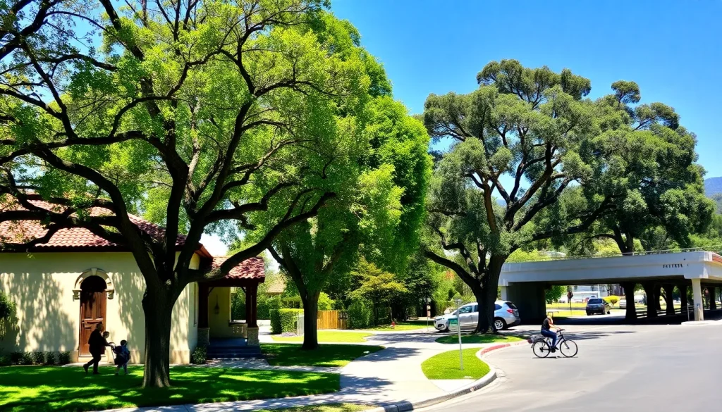
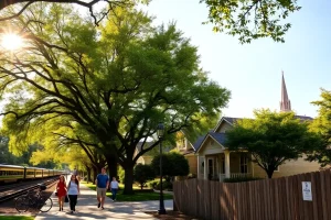
Crescent Park exudes a quiet, residential charm with a strong sense of community. Its streets are lined with mature trees—including majestic oaks, redwoods, and magnolias—that form a lush canopy. The neighborhood is predominantly single-family homes on generous lots, with a mix of architectural styles that reflect its evolution from a turn-of-the-20th-century suburb to a modern enclave. Residents value the area’s tranquility, walkability, and proximity to both nature and urban amenities. The neighborhood has a low-key, family-friendly atmosphere, with children often playing in front yards and neighbors gathering for block parties.
History
Crescent Park’s history dates to the early 1900s when Palo Alto was transitioning from a rural area to a residential community for Stanford University faculty and professionals. The neighborhood was part of the original Rancho Rincon de San Francisquito land grant. Its development accelerated after the 1906 San Francisco earthquake, which prompted many families to move to the Peninsula. The area was platted with large lots to attract affluent buyers, and many homes were designed by prominent architects of the era, including Birge Clark, who shaped much of Palo Alto’s early architectural identity. The neighborhood’s namesake park, Crescent Park, was established as a public green space in 1905 and remains a cherished landmark.
“Crescent Park has always been a place where families put down deep roots. You’ll find third-generation residents living next door to tech entrepreneurs—it’s a rare blend of history and innovation.” — Longtime resident and local historian
Housing and architecture
Crescent Park is renowned for its architectural diversity and well-preserved historic homes. The housing stock includes:
- Colonial Revival: Symmetrical facades, columns, and brick detailing, popular in the 1910s-1930s.
- Craftsman Bungalows: Low-pitched roofs, exposed rafters, and front porches, dating from the early 20th century.
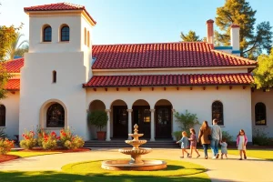
- Spanish Eclectic: Stucco walls, red tile roofs, and arched doorways, from the 1920s-1930s.
- Mid-Century Modern: Clean lines, large windows, and open floor plans, built in the 1950s-1960s.
- New Traditional and Contemporary: Recent infill development often mimics historic styles or introduces modern designs, subject to strict design guidelines.
Lot sizes typically range from 6,000 to over 15,000 square feet, with homes averaging 2,500 to 5,000 square feet. The neighborhood is subject to Palo Alto’s historic preservation ordinances, and many properties are listed on the California Register of Historical Resources. Teardowns and mansionization are ongoing concerns, with the city enforcing regulations to maintain neighborhood character.
Parks and natural features
The neighborhood’s namesake, Crescent Park, is a small triangular park at the intersection of University Avenue and Middlefield Road. It features a central lawn, benches, and a historic fountain, serving as a quiet retreat. Just outside the neighborhood’s southern boundary lies Rinconada Park, a 17-acre community park with a swimming pool, tennis courts, playgrounds, and the Palo Alto Art Center. The Palo Alto Baylands Nature Preserve is a short drive or bike ride away, offering 1,940 acres of marshland trails and birdwatching. Street trees are a defining natural feature, with the city’s urban forest program maintaining a diverse canopy of over 300 species.
Schools and community facilities
Crescent Park is served by the highly acclaimed Palo Alto Unified School District. Assigned schools include:
- Addison Elementary School (K-5) – located at 650 Addison Avenue, known for its strong academic programs and parent involvement.
- Frank S. Greene Jr. Middle School (6-8) – a California Distinguished School with robust STEM and arts offerings.
- Palo Alto High School (9-12) – consistently ranked among the top public high schools in the nation, with a wide range of Advanced Placement courses and extracurriculars.
Nearby private schools include Castilleja School (6-12, all-girls) and International School of the Peninsula (preschool-8, bilingual). Community facilities include the Palo Alto Family YMCA on Ross Road and the Palo Alto Children’s Library on Harriet Street, both within walking distance.
Transportation and walkability
Crescent Park boasts excellent walkability and bikeability. The neighborhood scores high on Walk Score due to its proximity to downtown. Key transportation features:
- Caltrain: The Palo Alto station at University Avenue is a 5-10 minute walk, providing commuter rail service to San Francisco and San Jose.
- Bus: VTA bus lines 22 and 522 run along University Avenue, connecting to Stanford and East Palo Alto.
- Biking: Dedicated bike lanes on University Avenue and Middlefield Road, plus the Bryant Street Bicycle Boulevard, make cycling safe and convenient.
- Highway access: U.S. Route 101 is approximately 1.5 miles east via Embarcadero Road, and Interstate 280 is 3 miles west via Page Mill Road.
Most daily errands can be accomplished on foot or by bike, reducing car dependency.
Shops and everyday services
While Crescent Park itself is exclusively residential, the northern boundary along University Avenue is a major commercial corridor. Within a 5-10 minute walk, residents have access to:
- Grocery: Whole Foods Market, Trader Joe’s, and Piazza’s Fine Foods.
- Dining: A wide range of restaurants from casual cafes to fine dining, including Evvia Estiatorio, Tamarine, and Coupa Cafe.
- Retail: Boutiques, bookstores (Books Inc.), and home goods stores.
- Services: Banks, dry cleaners, salons, and medical offices.
The nearby Stanford Shopping Center offers upscale retail and is a 5-minute drive or 15-minute bike ride away.
Notable landmarks
While Crescent Park is primarily residential, several landmarks define its character:
- Crescent Park (the park): The neighborhood’s namesake green space with a historic fountain, often used for small gatherings.
- Historic Homes: Numerous residences designed by Birge Clark, including the Norris House (1927) at 1235 Middlefield Road, a prime example of Spanish Colonial Revival.
- University Avenue Underpass: A pedestrian and bike tunnel connecting Crescent Park to downtown, adorned with public art.
- Palo Alto Caltrain Station: A Mission Revival-style depot built in 1940, just outside the neighborhood’s eastern edge.
Current planning issues
Crescent Park faces several ongoing planning discussions:
- Historic Preservation vs. Development: Balancing the protection of historic structures with the demand for larger, modern homes. The city’s Historic Resources Board reviews demolition permits and new construction.
- Mansionization: Concerns over oversized homes that are out of scale with existing lots, leading to updated zoning regulations and design guidelines.
- Traffic Calming: Efforts to reduce cut-through traffic on residential streets, particularly along Middlefield Road and Embarcadero Road.
- Climate Resilience: Increasing tree canopy and implementing green infrastructure to combat urban heat island effects.
What residents should know
Prospective residents should be aware of the following:
- Historic District Overlay: Some parts of Crescent Park are subject to additional review for exterior alterations, so check with the city before renovating.
- Neighborhood Association: The Crescent Park Neighborhood Association is active and hosts events like the annual 4th of July parade and block parties.
- Parking: Street parking is generally ample, but permits may be required in certain areas during downtown events.
- Wildlife: Residents occasionally encounter deer, raccoons, and a variety of birds, a reminder of the area’s natural setting.
Nearby neighborhoods
| Neighborhood | Distance | Key Characteristics |
|---|---|---|
| Professorville | Adjacent (south) | Historic district with Craftsman and Colonial Revival homes, home to many early Stanford professors. |
| Downtown Palo Alto | Adjacent (north) | Commercial core with shops, restaurants, and high-rise apartments. |
| Old Palo Alto | 0.5 miles west | Large lots, pre-1940 homes, and a quiet, suburban feel. |
| Community Center | 0.7 miles south | Mid-century homes, Rinconada Park, and the Palo Alto Art Center. |
FAQ
Is Crescent Park a good neighborhood for families?
Yes, Crescent Park is highly sought-after by families due to its top-rated schools (Addison Elementary, Greene Middle, Palo Alto High), low traffic streets, and strong community feel. The neighborhood hosts family-friendly events like an annual 4th of July parade, and its proximity to parks and downtown adds to its appeal.
What is the average home price in Crescent Park?
As of 2025, home prices in Crescent Park typically range from $4 million to over $10 million, depending on lot size, architectural significance, and condition. The neighborhood's historic status and limited inventory contribute to premium pricing. For current data, consult a local real estate agent or online platforms like Zillow.
Are there any restrictions on remodeling historic homes?
Yes, many properties in Crescent Park are listed on the California Register of Historical Resources or are subject to Palo Alto's Historic Resources Board review. Exterior alterations, demolitions, and new construction must comply with the city's Historic Preservation Ordinance, which may require design approval to maintain neighborhood character. Always check with the city's planning department before starting a project.
How walkable is Crescent Park to downtown Palo Alto?
Extremely walkable. The neighborhood's northern boundary is University Avenue, the main downtown thoroughfare. Most residents can reach shops, restaurants, and the Caltrain station within a 5-15 minute walk. The University Avenue underpass provides a safe pedestrian and bike connection under the railroad tracks.
Leave a Reply