Short Answer
Where is University South?
University South is a centrally located residential neighborhood in Palo Alto, California, immediately south of the city’s vibrant downtown core. It sits on the flatlands of the San Francisco Peninsula, roughly two miles north of the Stanford University campus and about 35 miles south of San Francisco. The neighborhood is often described as the southern gateway to downtown Palo Alto, offering a tranquil, tree-shaded retreat just steps from the restaurants, boutiques, and cultural venues of University Avenue. Its prime location makes it one of the most desirable and walkable areas in Silicon Valley, attracting a mix of long-time residents, Stanford affiliates, and tech professionals.
Boundaries and map
The official boundaries of University South are clearly defined by major thoroughfares and a historic expressway:
- North: University Avenue – the main commercial artery of downtown Palo Alto, separating University South from the Professorville and Downtown North neighborhoods.
- West: Alma Street – a tree-lined residential street that also serves as a border with the railroad tracks and the Crescent Park neighborhood beyond.
- South: Oregon Expressway – a sunken, limited-access highway that forms a physical and audible boundary with the Evergreen Park and Midtown neighborhoods to the south.
- East: Middlefield Road – a major north-south arterial that separates University South from the Community Center neighborhood and provides access to Highway 101.
The neighborhood is roughly rectangular, covering about 0.4 square miles. Its internal street grid is classic Palo Alto, with wide, quiet avenues lined by mature sycamores, oaks, and liquidambars. Key internal streets include Addison Avenue, Cowper Street, and Webster Street, which are known for their architectural significance.
Character of the neighborhood
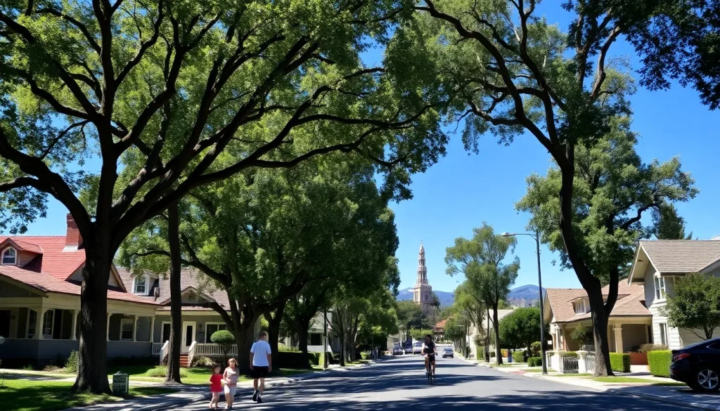
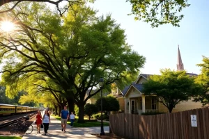
University South exudes a calm, established ambiance that belies its proximity to the bustling downtown. The streets are exceptionally walkable, with broad sidewalks and little through-traffic, making it a favorite for families with young children and anyone who enjoys a pedestrian-friendly environment. The neighborhood has a strong sense of community, fostered by block parties, an active neighborhood association, and the presence of Addison Elementary School as a social hub. Mature trees form a continuous canopy over many streets, providing shade and a sense of enclosure that is rare in newer subdivisions. The architectural variety—from restored Craftsman bungalows to elegant Spanish Colonial Revival homes—gives the area a distinctive, timeless character. Residents often describe it as a peaceful oasis in the middle of a dynamic city.
“Living in University South means you can walk to a world-class performance at The Stanford Theatre, grab a coffee on University Avenue, and still be home in five minutes. It’s the best of both worlds—urban convenience and suburban tranquility.” — Longtime resident and neighborhood association member
History
University South’s development is closely tied to the growth of Palo Alto and Stanford University. The area was originally part of the Rancho Rinconada del Arroyo de San Francisquito, a Mexican land grant. After the railroad arrived in the 1860s and Stanford opened in 1891, the demand for faculty and staff housing spurred the subdivision of land south of University Avenue. The neighborhood began to take shape in the early 1900s, with many homes built between 1905 and 1925. Unlike the more formal Professorville to the north, University South attracted a broader mix of professionals, merchants, and university employees. The opening of Oregon Expressway in the 1960s altered the southern edge, but the core of the neighborhood retained its historic fabric. In 2001, a portion of the area was listed on the National Register of Historic Places as the University South Historic District, recognizing its concentration of well-preserved early 20th-century residences.
Housing and architecture
University South is renowned for its architectural diversity and high-quality historic housing stock. The neighborhood contains one of the largest collections of early 20th-century homes in Palo Alto, with styles including:
- Craftsman Bungalows: Characterized by low-pitched roofs, wide front porches, exposed rafters, and extensive use of natural wood. Many have been meticulously restored.
- Spanish Colonial Revival: Stucco exteriors, red tile roofs, arched doorways, and wrought-iron details, reflecting the California romanticism of the 1920s.
- Colonial Revival and Tudor Revival: Symmetrical facades, brick or wood siding, and steeply pitched roofs add to the eclectic streetscape.
- Mid-Century Modern: A smaller number of post-war homes and apartment buildings, some with clean lines and large windows, are scattered throughout.
Lot sizes are typically 5,000 to 7,000 square feet, with homes ranging from 1,200 to over 3,000 square feet. Many properties have been expanded or updated, but strict historic preservation guidelines apply within the historic district, requiring review of exterior alterations. The median home price in University South consistently ranks among the highest in Palo Alto, often exceeding $3.5 million, reflecting the premium placed on location, charm, and school access. Rental opportunities are limited, mostly consisting of accessory dwelling units (ADUs) and a few small apartment buildings along the edges.
Parks and natural features
While University South is primarily residential, it offers several green spaces and is within easy reach of larger parks:
- Heritage Park: Located at the corner of Homer Avenue and Cowper Street, this 1.4-acre park is the neighborhood’s central gathering spot. It features a children’s playground, picnic tables, a large grassy field, and a community garden. The park also houses the historic Heritage House, a restored 1905 Craftsman home that serves as a museum and event space.
- Eleanor Pardee Park: Just outside the western boundary on Center Drive, this 4.6-acre park offers tennis courts, a playground, and open lawns, and is a short walk for many residents.
- Street trees: The urban forest is a defining natural feature. The City of Palo Alto’s tree canopy covers over 40% of the neighborhood, with species including coast live oak, London plane, and liquidambar, providing habitat for birds and squirrels.
Schools and community facilities
University South is served by the highly acclaimed Palo Alto Unified School District (PAUSD). The neighborhood school is Addison Elementary School (650 Addison Avenue), a California Distinguished School known for its strong academic programs and active parent community. Addison is located within the neighborhood, making it a true walk-to-school experience for most families.
For middle school, students typically attend Jane Lathrop Stanford Middle School (JLS), located just south of Oregon Expressway. High school students attend Palo Alto High School (commonly known as Paly), situated across Oregon Expressway on El Camino Real, also within walking or biking distance. The neighborhood is also close to several private schools, including Castilleja School (all-girls, grades 6–12) on Bryant Street and St. Elizabeth Seton School (Catholic, K–8) in nearby Crescent Park.
Community facilities include the Palo Alto Children’s Library on Harriet Street, just north of University Avenue, and the Lucie Stern Community Center complex, which houses the Palo Alto Players theatre group, a community room, and the Junior Museum & Zoo—all within a 10-minute walk.
Transportation and walkability
University South is one of Palo Alto’s most walkable neighborhoods. With a Walk Score typically in the high 80s, daily errands can be accomplished on foot. The flat terrain and grid street pattern make walking and biking easy and safe, with dedicated bike lanes on Middlefield Road and Alma Street. The neighborhood is served by several public transit options:
- Caltrain: The Palo Alto station is a 15-minute walk or a short bike ride north on Alma Street, providing commuter rail service to San Francisco and San Jose.
- VTA Bus: Routes 22 and 522 run along El Camino Real, just west of Alma, connecting to Stanford, Mountain View, and San Jose.
- Palo Alto Link: The city’s free shuttle service has stops near the neighborhood, offering connections to downtown and the Stanford Research Park.
- Stanford Marguerite Shuttle: Free shuttles to the Stanford campus are accessible from downtown stops.
Oregon Expressway provides quick vehicular access to Highway 101 and Interstate 280, though its noise and visual impact are a consideration for homes on the southern edge. On-street parking is generally plentiful, but a residential permit program is in effect near the downtown boundary to manage commuter spillover.
Shops and everyday services
While University South itself is almost entirely residential, its northern boundary is University Avenue, one of the premier shopping and dining destinations on the Peninsula. Within a five-minute walk, residents have access to:
- Grocery stores: Whole Foods Market (on Emerson Street) and Trader Joe’s (on University Avenue) are both just outside the neighborhood.
- Pharmacies: CVS Pharmacy on University Avenue.
- Banks and services: Multiple banks, dry cleaners, and salons line University Avenue and adjacent streets.
- Dining: An array of restaurants ranging from casual cafes to fine dining, including local favorites like Evvia Estiatorio, Bird Dog, and Coupa Café.
- Farmers’ market: The Downtown Palo Alto Farmers’ Market is held on Saturdays on Gilman Street, just a few blocks away.
For larger shopping trips, the Town & Country Village shopping center and Stanford Shopping Center are a short drive or bike ride away.
Notable landmarks
- Heritage House (341 Homer Avenue): A beautifully preserved 1905 Craftsman bungalow that now operates as a museum and community event space, offering a glimpse into early Palo Alto life.
- Addison Elementary School (650 Addison Avenue): A historic school building dating from 1925, with later additions, that anchors the neighborhood and serves as a polling place and community meeting site.
- The Stanford Theatre (221 University Avenue): While technically just outside the northern boundary, this restored 1925 movie palace is a beloved landmark that defines the cultural edge of the neighborhood.
- University South Historic District: The district itself, listed on the National Register of Historic Places, encompasses over 200 contributing properties and is a landmark of early suburban planning.
Current planning issues
University South faces several ongoing planning discussions that reflect broader tensions in Palo Alto:
- Historic preservation vs. housing density: The historic district regulations protect the neighborhood’s character but also limit the ability to add new housing units, including ADUs, which is a point of debate given the regional housing crisis.
- Oregon Expressway noise and safety: Residents on the southern edge continue to advocate for improved sound walls and pedestrian/bicycle crossings over the expressway to better connect with Evergreen Park and Paly High School.
- Downtown commercial encroachment: The pressure to convert residential properties along University Avenue into offices or retail spaces is a recurring concern, with the neighborhood association actively monitoring zoning changes.
- Tree canopy preservation: As properties change hands and undergo renovation, the removal of mature trees has prompted calls for stronger heritage tree ordinances.
What residents should know
Living in University South comes with unique advantages and a few practical considerations:
- Historic district rules: If your home is within the historic district, any exterior changes visible from the street require a review by the Historic Resources Board. This includes windows, roofing, paint color in some cases, and additions. It preserves character but can add time and cost to renovations.
- School enrollment: Addison Elementary is a high-demand school. Verify your address with PAUSD to confirm enrollment boundaries, as they can shift. The walk-to-school culture is strong, and traffic around the school during drop-off and pick-up times can be congested.
- Neighborhood association: The University South Neighborhood Association (USNA) is very active, organizing social events, publishing a newsletter, and representing residents’ interests to the city. Membership is voluntary but highly recommended for staying informed.
- Noise and traffic: While the interior streets are quiet, homes on the perimeter—especially along Oregon Expressway and Middlefield Road—experience noticeable traffic noise. Double-paned windows are common in these locations.
- Parking permits: The area closest to downtown requires a residential parking permit (Zone A) to park on the street for more than two hours on weekdays. This is enforced to prevent commuter parking.
Nearby neighborhoods
University South is surrounded by several distinct neighborhoods, each with its own character. The following table provides a quick comparison:
| Neighborhood | Distance | Key Characteristics |
|---|---|---|
| Professorville | 0.2 miles north | Historic district with grand Craftsman and Colonial Revival homes, many built for Stanford professors; quieter, more formal streets. |
| Downtown | 0.1 miles north | Mixed-use core with high-rise apartments, condos, retail, and nightlife; very walkable but less residential character. |
| Evergreen Park | 0.3 miles south | Post-war and mid-century homes, larger lots, strong family community, excellent access to parks and Paly High School. |
| Community Center | 0.3 miles east | Mid-century ranch homes, proximity to Rinconada Park and the Lucie Stern Center, slightly more suburban feel. |
| Crescent Park | 0.5 miles northwest | Affluent, estate-like properties, many with large lots and mature landscaping, adjacent to Eleanor Pardee Park. |
FAQ
Is University South a good neighborhood for families?
Yes, it is considered one of the best neighborhoods in Palo Alto for families. It offers a safe, walkable environment, a top-rated elementary school (Addison) within the neighborhood, and easy access to parks, libraries, and family-friendly downtown amenities. The strong community association and block party culture make it easy to connect with neighbors.
What are the restrictions on renovating a home in the historic district?
If your property is a contributing structure within the University South Historic District, any exterior alterations visible from the public right-of-way require a Certificate of Appropriateness from the Historic Resources Board. This includes changes to windows, doors, roofing, siding, and additions. Interior renovations are generally not regulated. The process is designed to preserve the district's architectural integrity, and early consultation with city staff is recommended.
How noisy is Oregon Expressway for homes on the southern edge?
Homes directly adjacent to Oregon Expressway experience noticeable traffic noise, particularly during peak commute hours. The expressway is below grade, which helps, but sound walls are not continuous. Many homeowners have installed double- or triple-paned windows and enhanced insulation. Properties a block or more away typically do not have significant noise issues.
Can I park on the street without a permit?
In most of University South, street parking is unrestricted. However, the area closest to University Avenue falls within the Downtown Residential Preferential Parking Zone A. In this zone, parking is limited to two hours on weekdays unless you have a resident permit. Check the city's parking map for specific streets.
Leave a Reply