Short Answer
Introduction
Relocating to Palo Alto, California, means joining a city that punches far above its weight in global influence. Nestled in the heart of Silicon Valley, this community of approximately 68,000 residents is synonymous with innovation, world-class education, and an exceptional quality of life. Yet, moving here requires a nuanced understanding of its distinct neighborhoods, a transportation ecosystem that blends historic rail with cutting-edge shuttles, and a rich tapestry of public resources. This guide serves as an encyclopedic reference for prospective residents, offering a deep dive into the geography, infrastructure, and civic assets that define Palo Alto. Whether you are drawn by Stanford University, the tech economy, or the tree-lined streets, the information that follows will equip you with the knowledge to navigate your relocation with confidence.
Overview
Palo Alto occupies a unique position on the San Francisco Peninsula, stretching from the San Francisco Bay in the northeast to the foothills of the Santa Cruz Mountains in the southwest. Founded in 1894, the city has evolved from a quiet college town into a global epicenter of technology and venture capital. Its boundaries encompass Stanford University, a sprawling research park, and a historic downtown. The city is governed by a council-manager system and is known for its engaged citizenry and progressive policies. According to the U.S. Census Bureau, the population was 68,572 in 2020, with a median household income exceeding $170,000, reflecting the area’s highly educated workforce. The climate is Mediterranean, with mild, wet winters and warm, dry summers, making outdoor recreation a year-round pursuit.
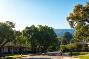
Palo Alto’s built environment is a palimpsest of its history: from the early 20th-century Craftsman homes in Professorville to the mid-century modern Eichlers of Greenmeadow and the sleek, contemporary designs of Crescent Park. The city is divided into 13 officially recognized neighborhoods, each with a distinct character, housing stock, and proximity to amenities. Understanding these neighborhoods is the first step in a successful relocation. Equally important is the transportation network, which includes Caltrain commuter rail, Valley Transportation Authority (VTA) buses, the city’s own Palo Alto Link shuttle, and an extensive system of bike boulevards. Community resources—from top-ranked public schools to a robust library system and numerous parks—further enhance the residential experience.
Key Concepts
Neighborhood Identity and Zoning
Palo Alto’s neighborhoods are not merely geographic divisions; they are shaped by specific zoning regulations, architectural styles, and historical development patterns. The city’s Comprehensive Plan designates land use categories that influence density, building height, and the mix of residential and commercial uses. For example, the R-1 (single-family residential) zone dominates much of the city, preserving the low-rise character of areas like Old Palo Alto and Barron Park. In contrast, the downtown commercial district allows mixed-use developments with ground-floor retail and upper-story housing. Recent policy shifts, such as the 2023 Housing Element, aim to increase multifamily housing near transit corridors to meet state mandates, sparking ongoing community debate about growth and preservation.
Transportation Hierarchy
Mobility in Palo Alto is defined by a multi-layered system. Caltrain serves as the regional backbone, connecting San Francisco to San Jose and Gilroy, with two stations in Palo Alto: the historic University Avenue station and the California Avenue station. VTA buses provide local and express routes, while the Palo Alto Link on-demand shuttle service (launched in 2023) offers curb-to-curb rides within the city for a flat fare. The city boasts over 40 miles of bike lanes and paths, and a Bicycle and Pedestrian Transportation Plan that prioritizes active transportation. Major arterial roads—El Camino Real, Alma Street, and Oregon Expressway—carry the bulk of vehicular traffic, often leading to peak-hour congestion. Understanding this hierarchy is essential for daily commuting and reducing car dependency.
Community Resource Ecosystem
Palo Alto’s community resources are deeply integrated into daily life. The Palo Alto Unified School District (PAUSD) is a primary draw for families, consistently ranking among the top districts in California. The city’s library system, with five branches, offers more than books: it provides maker spaces, digital resources, and community programs. The Community Services Department manages parks, recreation centers, and senior services, while numerous non-profits and neighborhood associations foster civic engagement. Stanford University acts as a quasi-public resource, opening its campus, museums, and lectures to residents. This ecosystem creates a high level of social capital but also contributes to the city’s high cost of living.
Benefits
Exceptional Educational Opportunities
For families, the public school system is a paramount benefit. PAUSD operates 12 elementary schools, 3 middle schools, and 2 high schools (Palo Alto High School and Henry M. Gunn High School), both of which are nationally recognized. In 2023, Niche.com ranked PAUSD as the #1 school district in the San Francisco Bay Area. The district’s commitment to academic excellence is complemented by strong music, arts, and athletics programs. Additionally, the presence of Stanford University provides access to world-class lectures, cultural events, and continuing education courses, enriching the intellectual life of the entire community.
Robust Transportation Options
Residents enjoy a rare combination of transit choices that reduce reliance on personal vehicles. Caltrain’s electrification project, completed in 2024, has increased service frequency and reduced travel times, making the commute to San Francisco or San Jose more efficient. The Palo Alto Link shuttle fills first- and last-mile gaps, particularly for seniors and those without cars. The city’s flat terrain and extensive bike network encourage cycling; over 10% of residents commute by bicycle, one of the highest rates in the nation. This multimodal infrastructure supports a lower carbon footprint and a healthier lifestyle.
Abundant Parks and Open Space
Palo Alto dedicates over 4,000 acres to parks, preserves, and open space. The crown jewel is the Baylands Nature Preserve, a 1,940-acre marshland with 15 miles of trails for hiking, birdwatching, and kayaking. Neighborhood parks like Rinconada, Mitchell, and Eleanor Pardee offer playgrounds, sports fields, and picnic areas. The foothills provide access to the Pearson-Arastradero Preserve and the larger Midpeninsula Regional Open Space District network. This commitment to green space enhances mental well-being and provides a respite from the urban tech environment.
Thriving Innovation Economy
Living in Palo Alto places residents at the epicenter of the global technology industry. The city is home to the headquarters of Hewlett-Packard (founded in a garage here in 1939), VMware, and Palantir, as well as the venture capital firms on Sand Hill Road. The Stanford Research Park hosts over 150 companies. For entrepreneurs and tech professionals, the proximity to investors, talent, and networking opportunities is unparalleled. This economic dynamism translates into high property values and a constant influx of new ideas and cultural diversity.
Challenges
High Cost of Living
The most significant barrier to moving to Palo Alto is the cost. As of mid-2024, the median home price exceeds $3.5 million, and the median rent for a one-bedroom apartment hovers around $3,800 per month. These figures place Palo Alto among the most expensive cities in the United States. The high cost is driven by limited housing supply, stringent zoning, and intense demand from high-income tech workers. For many, this necessitates a trade-off between location and housing size, or a reliance on dual high incomes. The city’s below-market-rate (BMR) housing program offers some relief, but waitlists are long.
Traffic Congestion
Despite excellent transit options, traffic congestion remains a daily frustration. Major arteries like El Camino Real, Page Mill Road, and Oregon Expressway experience heavy peak-hour volumes. The influx of commuters from neighboring cities and the concentration of jobs in the Stanford Research Park exacerbate the problem. While the city has implemented intelligent traffic signals and promotes alternative modes, the fundamental imbalance between jobs and housing in the region means congestion is a persistent challenge. The 2023 average commute time for Palo Alto residents was 26.5 minutes, but cross-town trips can take significantly longer during rush hour.
Housing Shortage and Affordability Crisis
Palo Alto’s jobs-to-housing ratio is severely skewed. The city has added far more jobs than housing units over the past two decades, leading to a regional housing crisis. State mandates require the city to plan for 6,086 new housing units by 2031, a target that has sparked contentious debates over neighborhood character, density, and infrastructure capacity. The slow pace of development and community resistance to multifamily projects have kept supply tight, pushing prices ever higher and displacing long-time residents and lower-income workers.
Income Inequality and Socioeconomic Divides
The concentration of wealth in Palo Alto has created stark socioeconomic divides. While the median household income is exceptionally high, a significant portion of the population—including service workers, teachers, and artists—struggles to afford housing. The city’s homeless population, though small in absolute numbers, is visible and a subject of ongoing policy debate. This inequality can manifest in the public schools, where the district grapples with issues of equity and access, and in the broader community, where the lack of economic diversity can feel isolating to those not in the tech sector.
Best Practices
Choosing the Right Neighborhood
Prospective residents should align their lifestyle, budget, and priorities with a neighborhood’s characteristics. For families seeking top schools and a suburban feel, Old Palo Alto and Crescent Park offer large lots and historic charm, but at a premium. Midtown and South Palo Alto provide more moderately priced (by local standards) mid-century homes and excellent access to parks and schools. Downtown and Professorville appeal to those who want walkability to shops, restaurants, and Caltrain. Barron Park and Greenmeadow offer a quieter, more rustic atmosphere with strong community associations. Renters may find more options in the California Avenue area or in newer mixed-use buildings downtown. It is advisable to visit at different times of day and week to gauge traffic, noise, and neighborhood activity.
Navigating the Transportation Network
To minimize commute stress, new residents should explore multimodal options. Purchasing a Clipper Card is essential for seamless payment on Caltrain, VTA, and other Bay Area transit systems. The Palo Alto Link app allows on-demand booking for short trips within the city. For cyclists, the city’s bike map highlights the safest routes, including the Bryant Street Bicycle Boulevard. If driving is necessary, consider the location of major employers and the timing of peak traffic. Many residents use a combination of biking to Caltrain and then taking the train to work. Parking downtown is metered and can be scarce; a residential parking permit may be needed in certain zones.
Engaging with Community Resources
Integration into Palo Alto life is accelerated by tapping into its resources. Obtain a library card immediately; the Palo Alto City Library offers not only books but also free access to online learning platforms, streaming services, and community events. Enroll children in PAUSD as early as possible, and explore the district’s Parent Teacher Association (PTA) networks. The city’s Recreation & Community Services catalog lists classes, sports leagues, and summer camps. Joining a neighborhood association, such as the Palo Alto Neighborhoods Association (PANA), provides a voice in local issues. For newcomers, the Palo Alto Newcomers Club is a valuable social and informational resource.
Understanding the Housing Market
Given the competitive market, it is critical to work with a local real estate agent who understands the nuances of each neighborhood and the intricacies of disclosure laws. Be prepared for multiple offers and all-cash transactions, especially in the entry-level single-family home segment. For those seeking below-market-rate units, monitor the city’s BMR Rental and Ownership Program for lottery opportunities. Renters should be aware of the city’s Rent Stabilization Ordinance, which limits annual rent increases for most multi-family buildings constructed before 1995. Always verify school attendance boundaries, as they can shift and do not always align with neighborhood names.
Tools & Resources
Official City and Government Portals
- City of Palo Alto Website (cityofpaloalto.org): The central hub for all municipal services, permits, council agendas, and department contacts.
- Palo Alto 311: A mobile app and online portal for reporting non-emergency issues like potholes, graffiti, and streetlight outages.
- Open Data Portal: Access to city datasets on crime, building permits, and demographics for those who want to analyze trends.
Transportation Planning Tools
- Caltrain (caltrain.com): Schedules, fares, and real-time train tracking.
- VTA (vta.org): Bus routes, light rail information, and trip planner.
- Palo Alto Link (paloaltolink.com): On-demand shuttle booking and service area map.
- Palo Alto Bike Map: A downloadable PDF showing bike lanes, paths, and bike parking locations.
- 511.org: The Bay Area’s comprehensive trip planner and traffic information resource.
Housing and School Research
- Palo Alto Unified School District (pausd.org): Enrollment information, school locator, and academic calendars.
- Zillow / Redfin: For current real estate listings and market trends (use with caution; verify with a local agent).
- City of Palo Alto BMR Program: Information on affordable housing lotteries and eligibility.
- Santa Clara County Assessor’s Office: Property records and tax information.
Community and Recreation
- Palo Alto City Library (library.cityofpaloalto.org): Catalog, events, and digital resources.
- Enjoy! Palo Alto Recreation Guide: Seasonal catalog of classes, camps, and activities.
- Palo Alto Newcomers Club (paloaltonewcomers.com): Social events and interest groups for new residents.
- Stanford University Events Calendar (events.stanford.edu): Public lectures, performances, and exhibitions.
Future Trends
Housing Element Implementation and Density
The 2023-2031 Housing Element commits Palo Alto to planning for over 6,000 new housing units, with a focus on affordable and multi-family housing near transit corridors. This will likely reshape areas along El Camino Real and around the California Avenue Caltrain station. Expect increased construction of four- to six-story mixed-use buildings, and continued debate over the impact on traffic, schools, and neighborhood character. The state’s “builder’s remedy” provisions could accelerate projects if the city fails to meet its deadlines, potentially altering the cityscape more rapidly than in past decades.
Transportation Electrification and Micromobility
Caltrain’s electrification is just the beginning. The city is expanding its network of electric vehicle charging stations and exploring partnerships for shared electric bikes and scooters. The Vision Zero initiative aims to eliminate traffic fatalities through street redesigns, lower speed limits, and improved pedestrian infrastructure. The rise of autonomous vehicle testing in the area may eventually transform last-mile connectivity, though regulatory frameworks are still evolving. The bicycle network will continue to expand, with more protected intersections and separated bike lanes planned.
Climate Resilience and Sustainability
Palo Alto has committed to carbon neutrality by 2030. Future developments will emphasize all-electric buildings, solar power, and water conservation. The Baylands face sea-level rise threats, and the city is engaged in long-term planning for levee improvements and habitat restoration. Community choice energy programs, like Palo Alto Green, will offer residents 100% renewable electricity. These sustainability efforts will influence building codes, landscaping norms, and transportation choices, making the city a living laboratory for green urbanism.
Evolving Community Services
The library system is transforming into a digital innovation hub, with expanded maker spaces, podcasting studios, and technology lending. The city is piloting universal basic income-style programs and expanding mental health services. As the population ages, senior services and accessible housing will become a greater priority. The relationship between the city and Stanford University will continue to evolve, with potential new joint projects in education, arts, and transportation.
Conclusion
Moving to Palo Alto is a decision that offers unparalleled access to intellectual capital, natural beauty, and a high-functioning civic infrastructure. The city’s neighborhoods, from the historic elegance of Professorville to the family-friendly streets of Midtown, provide a range of living environments, each with its own trade-offs. The transportation network, while challenged by congestion, is among the most progressive in the region, offering realistic alternatives to the single-occupancy vehicle. Community resources, anchored by an exceptional school district and a responsive local government, create a supportive environment for newcomers. However, the extreme cost of living and the pressures of growth demand careful planning and realistic expectations. By understanding the key concepts, leveraging the tools and resources outlined here, and engaging with the community, new residents can not only navigate the challenges but also thrive in one of the world’s most dynamic cities.
“Palo Alto is a city of villages. Each neighborhood has its own rhythm and identity. The key to a successful move is to match your daily life—commute, school run, weekend recreation—to the neighborhood that supports it best. Don’t just buy a house; buy into the lifestyle that surrounds it.” — Dr. Elena Torres, Urban Planning Consultant and 20-year Palo Alto resident
FAQ
What are the best neighborhoods for families in Palo Alto?
Neighborhoods like Old Palo Alto, Professorville, and Greenmeadow are popular with families due to their quiet streets, proximity to top-rated schools, and strong community associations. Each of the 13 official neighborhoods offers distinct character and housing styles.
How is the public transportation in Palo Alto?
Palo Alto has a robust multimodal network. Caltrain provides regional rail service with two stations, VTA buses run local and express routes, and the Palo Alto Link on-demand shuttle offers curb-to-curb rides. The city also features over 40 miles of bike lanes and a flat terrain ideal for cycling.
What is the cost of living in Palo Alto?
Palo Alto is one of the most expensive cities in the U.S. As of mid-2024, the median home price exceeds $3.5 million, and median rent for a one-bedroom apartment is around $3,800 per month. High demand, limited housing supply, and stringent zoning drive these costs.
What are the top schools in Palo Alto?
The Palo Alto Unified School District (PAUSD) operates 12 elementary, 3 middle, and 2 high schools—Palo Alto High and Henry M. Gunn High—both nationally recognized. Niche.com ranked PAUSD the #1 school district in the San Francisco Bay Area in 2023.
What outdoor activities are available in Palo Alto?
Residents enjoy over 4,000 acres of parks and open space. The Baylands Nature Preserve offers 15 miles of trails for hiking and birdwatching, while neighborhood parks like Rinconada and Mitchell provide sports fields and playgrounds. The foothills connect to the Midpeninsula Regional Open Space District for additional recreation.
Is Palo Alto a good place for tech professionals?
Yes. Palo Alto is the heart of Silicon Valley, home to Hewlett-Packard’s founding garage, VMware, Palantir, and the Stanford Research Park. Proximity to venture capital on Sand Hill Road and a dense network of startups and talent make it an unparalleled location for tech careers.
Leave a Reply