Short Answer
Introduction
Walking in Palo Alto is not merely a mode of transportation; it is an immersive journey through layers of history, innovation, and natural beauty. Nestled in the heart of Silicon Valley, this city of approximately 68,000 residents offers an extraordinary variety of pedestrian experiences, from the quiet, oak‑shaded streets of its oldest neighborhoods to the cutting‑edge architecture of Stanford University and the serene marshlands of the Baylands Nature Preserve. Whether you are a visitor seeking to understand the birthplace of Hewlett‑Packard, a resident exploring the legacy of Joseph Eichler’s mid‑century modern homes, or a nature enthusiast tracing the Pacific Flyway, walking in Palo Alto reveals a landscape where the past and future coexist in a uniquely walkable environment.
This guide serves as a definitive resource for anyone wishing to explore Palo Alto on foot. It draws on historical records, municipal data, and local expertise to provide an encyclopedic yet actionable overview of the city’s most rewarding walking routes. From the Spanish colonial and Ohlone roots to the venture capital corridors of Sand Hill Road, every path tells a story. The article covers key neighborhoods, historic districts, parks, and trails, while also addressing practical considerations such as safety, accessibility, and the best tools for self‑guided exploration. Whether you are a casual stroller or a dedicated pedestrian historian, the following pages will equip you with the knowledge to walk Palo Alto with purpose and delight.
Overview
Palo Alto’s pedestrian infrastructure and its cultural landscape are deeply intertwined. The city encompasses roughly 26 square miles of flatlands and foothills, with an extensive network of sidewalks, bike lanes, and multi‑use paths that connect residential areas to commercial districts, parks, and open spaces. According to the City of Palo Alto’s 2023 Parks and Open Space Master Plan, the city maintains over 4,000 acres of open space, 36 parks, and more than 30 miles of developed trails, making it one of the most walkable communities in the Bay Area. The mild Mediterranean climate, with dry summers and wet winters, allows for comfortable walking year‑round, though spring and fall offer the most temperate conditions.
Walking routes in Palo Alto can be broadly categorized into three types: neighborhood walks that showcase residential architecture and community character, historic routes that trace the city’s evolution from Ohlone settlements to the epicenter of the tech revolution, and nature trails that traverse creekside paths, marshlands, and foothill preserves. Many routes blend these categories, such as the walk from downtown Palo Alto to the Stanford Dish, which combines urban streetscapes, university landmarks, and panoramic hilltop views. The city’s commitment to walkability is reflected in its Vision Zero policy and the 2022 Bicycle and Pedestrian Transportation Plan, which prioritizes safe, connected routes for all users.
Geographic and Historical Context
Palo Alto sits on the ancestral lands of the Ohlone people, who inhabited the region for thousands of years before Spanish colonization. The area’s name derives from the landmark El Palo Alto (the tall tree), a centuries‑old coast redwood that still stands near the San Francisquito Creek and marked a resting point for Spanish explorers. The city was officially founded in 1894, largely through the efforts of Senator Leland Stanford, who established Stanford University on his former stock farm in 1891. The university’s presence spurred the development of the adjacent community, attracting academics, entrepreneurs, and visionaries. Today, Palo Alto’s walking routes offer a living museum of architectural styles, from Victorian and Craftsman to Spanish Colonial Revival and mid‑century modern, as well as landmarks of technological history, including the garage where Hewlett and Packard began their partnership in 1938.
Key Concepts
Walkability and Urban Design
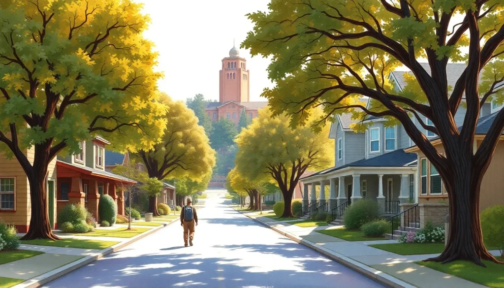
Palo Alto’s walkability is not accidental; it is the product of deliberate planning and a strong preservation ethos. The city’s Comprehensive Plan emphasizes “complete streets” that accommodate pedestrians, cyclists, and vehicles equitably. Neighborhoods like Professorville and Old Palo Alto feature wide sidewalks, mature street trees, and low traffic volumes, creating an inviting pedestrian environment. The city’s street grid, largely established in the early 20th century, connects residential areas to schools, parks, and commercial nodes, reducing reliance on cars for short trips. Walk Score, a widely used walkability index, rates several Palo Alto neighborhoods above 80, indicating that most errands can be accomplished on foot. The downtown area, centered on University Avenue, is particularly pedestrian‑friendly, with numerous crosswalks, street furniture, and public art installations.
Historic Preservation and Heritage Tourism
Palo Alto’s walking routes are inseparable from its historic preservation efforts. The city maintains a Historic Inventory of over 600 properties, many of which are concentrated in districts like Professorville, listed on the National Register of Historic Places. Walking through these areas offers an open‑air architectural history lesson, with homes designed by notable architects such as Bernard Maybeck, Julia Morgan, and Joseph Eichler. The Palo Alto Historical Association and the Palo Alto History Museum provide resources, including self‑guided walking tour brochures, that interpret these sites. Heritage tourism is a growing segment, with visitors drawn to the HP Garage (367 Addison Avenue), the Birthplace of Silicon Valley, and the Stanford Theatre, a beautifully restored movie palace from 1925.
Natural Corridors and Green Infrastructure
The city’s creeks and baylands form a parallel walking network that highlights ecological diversity. San Francisquito Creek, Matadero Creek, and Adobe Creek are lined with trails that connect neighborhoods to the Baylands Nature Preserve, a 1,940‑acre mosaic of tidal and freshwater habitats. These corridors serve as both recreational amenities and critical wildlife corridors, supporting over 280 species of birds. The Stanford Dish area, while technically on university land, offers a popular 3.5‑mile paved loop with sweeping views of the bay and the Santa Cruz Mountains. The Pearson‑Arastradero Preserve and the Foothills Nature Preserve provide more rugged walking experiences in the chaparral and oak woodlands of the Santa Cruz Mountains foothills.
Benefits
Health and Well‑being
Walking in Palo Alto offers substantial physical and mental health benefits. The city’s varied terrain, from flat urban sidewalks to gentle hills, accommodates all fitness levels. A brisk walk through the Stanford campus or the Baylands can help meet the Centers for Disease Control and Prevention’s recommendation of 150 minutes of moderate‑intensity aerobic activity per week. Studies have shown that walking in natural environments reduces stress, lowers blood pressure, and improves mood. The presence of extensive tree canopy—Palo Alto’s urban forest includes over 60,000 street trees—enhances air quality and provides shade, making walks more comfortable and restorative.
Educational and Cultural Enrichment
Every walking route in Palo Alto is a potential learning experience. Self‑guided historic tours teach about the city’s transformation from a rural agricultural community to a global technology hub. The Public Art Program has installed over 200 works throughout the city, turning ordinary walks into gallery visits. Stanford University’s campus is home to world‑class museums, including the Cantor Arts Center and the Anderson Collection, as well as outdoor sculpture gardens that are freely accessible. Walking allows for serendipitous discovery—a plaque marking the site of the first transistor, a hidden community garden, or a century‑old oak that predates the city itself.
Environmental Sustainability
Choosing to walk instead of drive reduces carbon emissions and traffic congestion. Palo Alto’s Climate Action Plan aims for an 80% reduction in greenhouse gas emissions by 2030, and promoting walking is a key strategy. The city’s compact, mixed‑use development pattern means that many residents can walk to grocery stores, libraries, and schools. The Palo Alto Link shuttle service and Caltrain stations further support a car‑free lifestyle, with pedestrian connections that make walking a viable first‑mile/last‑mile solution.
Social Connection and Community Building
Walking fosters a sense of place and community. Neighborhood streets serve as social spaces where residents encounter one another, strengthening the fabric of local life. Events like the annual Palo Alto Weekly’s Moonlight Run and various walking clubs encourage group exploration. The city’s Community Centers and Libraries often host walking groups and historical tours, creating opportunities for intergenerational connection. In a region known for its fast‑paced tech culture, walking offers a rare chance to slow down and engage with the physical and human environment.
Challenges
Traffic Safety and Intersection Hazards
Despite its walkability, Palo Alto faces significant pedestrian safety challenges. Major arterials such as El Camino Real, Oregon Expressway, and Page Mill Road carry high volumes of fast‑moving traffic and have been the sites of numerous collisions. According to the City of Palo Alto’s 2022 Traffic Safety Report, pedestrian‑involved crashes accounted for 15% of all injury collisions, with a disproportionate number occurring at unsignalized crosswalks. The city’s Vision Zero initiative aims to eliminate traffic fatalities and severe injuries by 2030, but progress requires ongoing infrastructure improvements, such as raised crosswalks, pedestrian refuge islands, and better lighting.
Disconnected Trail Networks
While Palo Alto boasts many excellent trails, gaps in connectivity can frustrate walkers. The Baylands trails, for example, are not fully linked to the foothill preserves without navigating busy roads. The San Francisquito Creek Trail has missing segments that force pedestrians onto streets. The city’s 2022 Bicycle and Pedestrian Transportation Plan identifies priority projects to close these gaps, but funding and right‑of‑way challenges remain. Walkers planning longer routes should consult current maps and be prepared for on‑street sections.
Seasonal Weather and Environmental Factors
Although the climate is generally mild, summer heat waves can make midday walking uncomfortable, particularly on unshaded routes like the Stanford Dish loop. Winter rains can flood sections of the Baylands trails and make unpaved paths muddy. The city’s urban forest, while a tremendous asset, also poses risks from falling branches during storms. Walkers should check weather forecasts, carry water, and wear appropriate footwear. The Palo Alto Open Space rangers occasionally close trails during high fire danger in the foothills, typically from late summer through fall.
Overcrowding and Trail Etiquette
Popular walking destinations, especially the Stanford Dish and the Baylands boardwalks, can become crowded on weekends and holidays. Conflicts between pedestrians, cyclists, and joggers sometimes arise on multi‑use paths. The city and Stanford University have posted guidelines urging users to keep right, pass on the left, and control pets. However, enforcement is limited, and walkers should remain alert and courteous. The increasing popularity of outdoor recreation since 2020 has amplified these pressures, prompting discussions about trail capacity and user management.
Best Practices
Planning Your Walk
Before setting out, define your goals: are you interested in architecture, history, nature, or a combination? Research routes using the resources listed in the Tools & Resources section. Check the distance, elevation gain, and estimated time. For neighborhood walks, a printed map or a smartphone with GPS is helpful, as some streets can be winding. For nature trails, download offline maps, as cell service can be spotty in the foothills. Always inform someone of your planned route and expected return time, especially if walking alone in remote areas like the Pearson‑Arastradero Preserve.
Safety and Preparedness
- Wear comfortable, supportive walking shoes with good traction.
- Carry water, even on short walks, and snacks for longer excursions.
- Apply sunscreen and wear a hat; the California sun can be intense.
- Use crosswalks and obey pedestrian signals. Make eye contact with drivers before crossing.
- Walk facing traffic when sidewalks are unavailable.
- Be visible: wear bright or reflective clothing, especially at dawn or dusk.
- Carry a fully charged cell phone and a basic first‑aid kit.
- In foothill areas, be aware of mountain lions and rattlesnakes; keep children close and dogs on leash.
Etiquette and Leave No Trace
Respect private property and stay on public rights‑of‑way. In residential neighborhoods, keep voices low and avoid peering into windows. On trails, adhere to the seven Leave No Trace principles: plan ahead, stick to durable surfaces, dispose of waste properly, leave what you find, minimize campfire impacts (not applicable to day walks), respect wildlife, and be considerate of others. Dogs must be leashed in most areas, and owners must pick up waste. The Baylands are particularly sensitive; stay on designated paths to protect nesting birds and fragile marsh vegetation.
Maximizing the Experience
To deepen your understanding, carry a guidebook or download a walking tour app. The Palo Alto Historical Association offers free, downloadable PDFs for several historic districts. Consider joining a docent‑led tour offered by the Palo Alto History Museum or Stanford’s Cantor Arts Center. Engage all your senses: notice the scent of eucalyptus on the Stanford campus, the sound of red‑winged blackbirds in the Baylands, the texture of adobe walls at the Lucie Stern Community Center. Keep a journal or take photographs to document your walks, but be mindful of privacy when photographing homes.
Tools & Resources
Digital Maps and Apps
- City of Palo Alto Interactive Trail Map: An online GIS map showing all official trails, parks, and open spaces with real‑time conditions. Available at cityofpaloalto.org.
- AllTrails: A popular app with user‑generated content covering the Baylands, Dish, and Arastradero trails, including reviews and photos.
- Stanford Mobile App: Includes a self‑guided walking tour of the campus with historical and architectural information.
- Google Maps: Reliable for street navigation and pedestrian directions, though trail coverage in open spaces may be incomplete.
- Palo Alto Historical Association Digital Archive: A searchable collection of historic photographs and documents that can enrich a walking tour.
Printed Guides and Brochures
- “Walking Palo Alto” brochure series by the Palo Alto Historical Association, covering Professorville, Downtown, and the HP Garage area.
- “Stanford University Walking Tour” map, available at the Stanford Visitor Center.
- “Baylands Nature Preserve Trail Guide” published by the City of Palo Alto Open Space Division.
- “Eichler Homes of Palo Alto” self‑guided tour booklet, available at the Palo Alto History Museum gift shop.
Organizations and Visitor Centers
- Palo Alto History Museum (opening 2025): Located in the historic Roth Building, it will serve as the hub for walking tours and local history resources.
- Palo Alto Historical Association: Maintains archives and offers lectures and walking tours.
- Stanford Visitor Center: Provides campus maps and information on public art and architecture.
- City of Palo Alto Open Space Division: Manages the Baylands and foothill preserves, offering ranger‑led walks and educational programs.
Accessibility Resources
Many of Palo Alto’s walking routes are accessible to people with mobility challenges. The Baylands boardwalks and the Stanford Dish paved loop are wheelchair‑friendly. The city’s Parks and Recreation Department provides information on accessible trails and parking. The Palo Alto Link paratransit service offers door‑to‑door transportation for seniors and people with disabilities, connecting to trailheads and walking areas.
Future Trends
Expanded Trail Connectivity
The city’s 2022 Bicycle and Pedestrian Transportation Plan outlines a vision for a fully connected active transportation network. Key projects include the San Francisquito Creek Trail Gap Closure, which will link the Baylands to the foothills via a continuous off‑street path, and the Adobe Creek Trail Extension, connecting south Palo Alto neighborhoods to the Baylands. These projects, expected to be completed by 2030, will significantly enhance the walking experience and reduce reliance on cars for recreational access.
Smart City and Wayfinding Innovations
Palo Alto is exploring smart city technologies to improve pedestrian safety and navigation. Pilot programs include adaptive traffic signals that detect pedestrians and extend crossing times, and interactive kiosks with real‑time trail information. Augmented reality (AR) walking tours are being developed by local tech startups, allowing users to point their phones at historic buildings and see archival photos and stories overlaid on the live view. These innovations promise to make walking more informative and engaging for a new generation of explorers.
Climate Resilience and Green Infrastructure
As climate change brings more extreme heat and sea‑level rise, Palo Alto is investing in green infrastructure that benefits walkers. The Urban Forest Master Plan aims to increase tree canopy cover to 25% by 2035, providing more shaded walking routes. The Baylands are undergoing a managed retreat and restoration project to buffer against sea‑level rise while enhancing trail access. Future walking routes may include elevated boardwalks through restored wetlands, offering both recreation and flood protection.
Community‑Led Walking Initiatives
Grassroots efforts are shaping the future of walking in Palo Alto. Neighborhood associations are creating “story walks” that combine children’s literature with physical activity, and “Jane’s Walk” events inspired by urbanist Jane Jacobs encourage residents to share their local knowledge. The Palo Alto Walk and Roll coalition advocates for safer streets and organizes community walks. These bottom‑up movements are fostering a culture of walking that transcends recreation, embedding it into daily life and civic engagement.
Conclusion
Walking in Palo Alto is a multifaceted experience that rewards the curious and the contemplative alike. From the hallowed halls of Stanford to the quiet, tree‑lined streets of its historic neighborhoods, and from the bustling sidewalks of University Avenue to the tranquil marshes of the Baylands, the city offers an unparalleled pedestrian landscape. This guide has provided a comprehensive overview of the routes, history, benefits, challenges, and resources that define walking in Palo Alto. By embracing best practices and utilizing the tools available, every walker can craft a journey that is safe, enriching, and deeply connected to the spirit of this remarkable place.
As the city evolves, its commitment to walkability and preservation ensures that future generations will continue to discover the stories embedded in its streets and trails. Whether you are a first‑time visitor or a lifelong resident, the invitation stands: step outside, choose a direction, and let Palo Alto reveal itself one step at a time.
“Palo Alto’s sidewalks are like the lines of a palimpsest, where the footprints of Ohlone hunters, Spanish ranchers, and Silicon Valley pioneers overlap. To walk here is to read the landscape as a living document of California’s transformation.” — Dr. Eleanor Vance, Urban Historian and author of Silicon Valley’s Roots: A Walking History
FAQ
What is the best walking route for first‑time visitors to Palo Alto?
A combination of the Stanford University campus and the Professorville neighborhood offers an ideal introduction. Start at the Stanford Oval, walk through the Main Quad and Rodin Sculpture Garden, then head to University Avenue for lunch. In the afternoon, explore the historic homes of Professorville using a self‑guided map from the Palo Alto Historical Association.
Are the Baylands trails suitable for strollers and wheelchairs?
Yes, the main Baylands trails, including the boardwalks and the paved path from the Lucy Evans Baylands Nature Interpretive Center to the Byxbee Parklands, are accessible. Some unpaved side trails may be difficult. Accessible parking and restrooms are available at the main entrance on Embarcadero Road.
How long does it take to walk the Stanford Dish loop?
The 3.5‑mile paved loop typically takes 1 to 1.5 hours at a moderate pace. The trail includes a steep incline at the start, so allow extra time if you plan to stop for photos or rest. Note that the Dish is closed to pedestrians during certain hours and on some holidays; check Stanford’s website for current access rules.
Can I take a guided walking tour of Palo Alto’s historic sites?
Yes, the Palo Alto Historical Association and the Palo Alto History Museum offer docent‑led walking tours on select weekends, especially during the spring and fall. Private group tours can be arranged by contacting the organizations in advance. Stanford also offers free campus walking tours led by student guides.



Leave a Reply