Short Answer
Where is Duveneck–St. Francis?
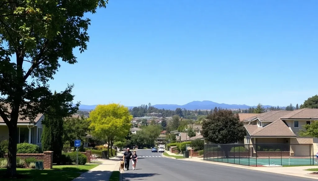
Duveneck–St. Francis is a residential neighborhood in the northernmost part of Palo Alto, California, nestled against the San Francisquito Creek and the border with Menlo Park. It lies approximately 2 miles north of downtown Palo Alto and 3 miles northwest of Stanford University. The neighborhood is primarily a collection of quiet, tree-shaded streets that radiate outward from Eleanor Pardee Park, offering a suburban atmosphere within one of Silicon Valley’s most desirable cities. Its location provides a rare blend of seclusion and connectivity: residents enjoy a peaceful, family-oriented environment while remaining minutes from major tech employers, Caltrain, and Highway 101.
Boundaries and map
The official boundaries, as recognized by the City of Palo Alto and the Duveneck–St. Francis Neighborhood Association, are:
- North: San Francisquito Creek (the San Mateo–Santa Clara county line)
- South: Embarcadero Road
- East: U.S. Highway 101 (Bayshore Freeway)
- West: Middlefield Road
These borders enclose a roughly rectangular area of about 0.8 square miles. The neighborhood is often subdivided into two smaller enclaves: Duveneck (west of Louis Road) and St. Francis (east of Louis Road), though they share a single neighborhood association and a common identity. A map of the area shows a grid-like street pattern with curvilinear elements introduced by the Eichler subdivisions, all sloping gently toward the Baylands to the east.
Character of the neighborhood
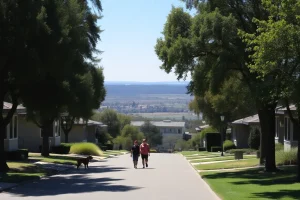
Duveneck–St. Francis exudes a calm, unhurried charm. The streets are wide and lined with mature camphor, liquidambar, and oak trees. Sidewalks are well-maintained, and front yards are meticulously landscaped, often featuring drought-tolerant native plants. The dominant architectural style is the mid-century modern Eichler home, with its low-pitched roof, exposed beams, and expansive glass walls that blur the line between indoors and out. This gives the neighborhood a distinctive visual coherence, even as newer, larger custom homes have begun to appear.
The community is notably engaged: the neighborhood association organizes block parties, a Fourth of July parade, and regular meetings on local issues. Families are drawn by the excellent public schools, while long-time residents appreciate the stability and neighborly feel. It is not uncommon to see children walking or biking to school, dog walkers greeting each other by name, and impromptu gatherings at Eleanor Pardee Park. The overall vibe is safe, inclusive, and quietly affluent.
History
The land that became Duveneck–St. Francis was originally part of the vast Rancho Rincon de San Francisquito, a Mexican land grant awarded in 1841 to José Peña. After California statehood, the rancho was subdivided, and the area remained agricultural orchards and estates through the early 20th century. The Duveneck name honors Frank and Josephine Duveneck, prominent conservationists and philanthropists who owned a large parcel here and later founded Hidden Villa in Los Altos Hills. The St. Francis designation derives from the St. Francis Acres subdivision, named after St. Francis of Assisi, reflecting the early presence of the Catholic church in the area.
The neighborhood’s modern form took shape after World War II, when developer Joseph Eichler purchased large tracts and built hundreds of his signature homes between 1954 and 1965. Eichler’s vision of affordable, architect-designed houses for the middle class attracted Stanford faculty, engineers, and young families. The area was annexed into Palo Alto in stages, and by the 1970s it had become a fully built-out suburban community. Today, the neighborhood is recognized for its historic Eichler clusters, some of which are eligible for the National Register of Historic Places.
Housing and architecture
Housing in Duveneck–St. Francis is overwhelmingly single-family detached homes, with a small number of duplexes and accessory dwelling units (ADUs) near major streets. The architectural landscape is defined by:
- Eichler homes: Approximately 60% of the housing stock. These mid-century modern houses feature post-and-beam construction, open floor plans, floor-to-ceiling windows, radiant heating, and signature atriums or courtyards. Models range from the modest 1,200-square-foot rancher to larger 2,000-square-foot two-story designs.
- Ranch-style homes: Built in the same era by other developers, these are typically single-story with low-pitched roofs and attached garages.
- Custom contemporary homes: In the last two decades, teardowns of non-Eichler properties have given way to larger, two-story homes in Modern, Mediterranean, or Craftsman styles. Strict design guidelines aim to preserve neighborhood character.
- Multi-family: A few small apartment buildings and condominium complexes exist along Embarcadero Road and near Highway 101.
Home prices are among the highest in Palo Alto, with median sales often exceeding $3 million. The Eichler homes command a premium due to their architectural significance and the strong preservation ethos of the community. The neighborhood is not a designated historic district, but the Duveneck–St. Francis Neighborhood Association actively advocates for sensitive renovations and additions.
Parks and natural features
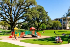
The neighborhood’s green heart is Eleanor Pardee Park, a 9.6-acre community park at 851 Center Drive. It features a children’s playground, tennis courts, a basketball court, a baseball diamond, picnic areas with barbecues, and a community center that hosts classes and events. The park’s large grassy fields are popular for soccer, frisbee, and informal gatherings.
Just south of Embarcadero Road lies Rinconada Park, one of Palo Alto’s largest parks, with a swimming pool, tennis courts, and the Palo Alto Art Center. To the east, the Baylands Nature Preserve offers 1,940 acres of marshland with trails for hiking, biking, and birdwatching. The San Francisquito Creek Trail runs along the northern boundary, providing a shaded path for walking and cycling that connects to the Baylands. Mature street trees throughout the neighborhood create a continuous canopy, and many homes back onto seasonal creeks or have views of the Santa Cruz Mountains.
Schools and community facilities
Duveneck–St. Francis is served by the highly acclaimed Palo Alto Unified School District (PAUSD). Public school assignments are:
- Duveneck Elementary School (K-5): Located within the neighborhood at 705 Alester Avenue. It consistently ranks among the top elementary schools in California, with strong parent involvement and a focus on project-based learning.
- Frank S. Greene Jr. Middle School (6-8): Formerly Jordan Middle School, located at 750 N. California Avenue, about 1.5 miles southwest.
- Palo Alto High School (9-12): Located at 50 Embarcadero Road, just across the southern boundary. Known as “Paly,” it offers a comprehensive curriculum and numerous Advanced Placement courses.
Private options include St. Francis of Assisi School (K-8) on Oak Grove Avenue, a Catholic parish school, and several preschools. The Palo Alto Family YMCA on Ross Road is a short drive away and provides fitness facilities, swim lessons, and youth programs. The Rinconada Library, part of the Palo Alto City Library system, is adjacent to Rinconada Park and offers storytimes, book clubs, and a makerspace.
Transportation and walkability
The neighborhood scores well for walkability and bikeability. Most streets have sidewalks and low traffic volumes, making it safe for pedestrians. Dedicated bike lanes run along Embarcadero Road and Middlefield Road, and the city’s bike boulevard network connects to downtown and Stanford. The Palo Alto Caltrain station at University Avenue is about 1.5 miles away, reachable by a 10-minute bike ride or the free Stanford Marguerite shuttle. Highway 101 is immediately accessible via the Embarcadero Road interchange, providing a direct route to San Francisco (35 miles north) and San Jose (20 miles south). VTA bus lines 21 and 22 serve Middlefield Road and Embarcadero, linking to the Palo Alto Transit Center. Many residents also use the Palo Alto Link on-demand shuttle service for local trips.
Shops and everyday services
Duveneck–St. Francis is almost entirely residential, so daily errands require a short trip outside the neighborhood. The closest commercial hub is Town & Country Village at Embarcadero Road and El Camino Real, a landscaped shopping center with a grocery store (Trader Joe’s), pharmacies, cafes, restaurants, and boutique shops. Downtown Palo Alto, along University Avenue, is 2 miles south and offers a wider array of dining, retail, and services. Within the neighborhood, a few small businesses operate on the edges: a dry cleaner, a dental office, and a convenience store near Middlefield. The Palo Alto Farmers’ Market on California Avenue (Sundays) is a popular weekend destination for fresh produce and artisanal goods.
Notable landmarks
While the neighborhood lacks grand monuments, its landmarks are architectural and natural. The Eichler homes themselves are a living museum of mid-century design, with several streets—such as St. Francis Drive and Center Drive—showcasing particularly intact clusters. Eleanor Pardee Park is a social landmark, hosting the annual Fourth of July parade and community picnics. The San Francisquito Creek and its riparian corridor are a defining natural feature, with a footbridge at Newell Road offering views of the waterway. The Duveneck House (not open to the public) at 1225 Middlefield Road is a historic 1920s Spanish Revival residence that predates the Eichler subdivisions and recalls the area’s estate era.
Current planning issues
Several planning topics are actively debated in the neighborhood:
- Teardowns and mansionization: The replacement of original ranch homes with large two-story houses has raised concerns about loss of character, overshadowing, and privacy. The city’s design guidelines are periodically reviewed to address bulk and massing.
- Accessory dwelling units (ADUs): State laws encouraging ADUs have led to an increase in backyard units, prompting discussions about parking, tree preservation, and infrastructure capacity.
- Flood resilience: Proximity to San Francisquito Creek puts parts of the neighborhood in a FEMA flood zone. The San Francisquito Creek Joint Powers Authority is implementing channel improvements and upstream detention projects to reduce flood risk.
- Traffic calming: Cut-through traffic on Louis Road and Newell Road has led to requests for speed humps, roundabouts, and enhanced crosswalks.
- Tree canopy protection: The neighborhood association works with the city to protect heritage trees and require replacement planting during construction.
What residents should know
Living in Duveneck–St. Francis comes with a few practical considerations:
- Wildlife: Deer, raccoons, skunks, and the occasional coyote are common. Residents should secure garbage and avoid leaving pets unattended outdoors at night.
- Flood insurance: Properties near the creek may be required to carry flood insurance. Check FEMA maps and consult the city’s floodplain manager.
- Neighborhood association: The Duveneck–St. Francis Neighborhood Association (DSFNA) is highly active. Annual dues are voluntary, but membership supports community events, a newsletter, and advocacy. The association’s email list is a vital source of local news, recommendations, and lost-pet alerts.
- School enrollment: PAUSD schools are a major draw, but enrollment is strictly tied to residency. Verify boundaries on the district website, as they can shift with new housing development.
- Noise: The neighborhood is generally quiet, but homes near Highway 101 experience some freeway hum. Sound walls and double-pane windows mitigate this.
- Utilities: Palo Alto Utilities provides electricity, water, gas, and fiber optic internet. Power outages are rare but can occur during winter storms.
“We moved here for the schools, but we stayed for the community. Our Eichler isn’t just a house—it’s a conversation starter and a connection to a design legacy that still feels modern 60 years later.” — A 15-year resident of St. Francis Drive
Nearby neighborhoods
Duveneck–St. Francis is surrounded by equally desirable Palo Alto and Menlo Park neighborhoods. The table below compares them at a glance.
| Neighborhood | Distance | Key Characteristics |
|---|---|---|
| Crescent Park | 0.5 miles west | Historic estate homes, larger lots, lush landscaping, no sidewalks in some areas |
| Professorville | 1.5 miles southwest | Early 20th-century Craftsman and Colonial Revival homes, Stanford faculty history, historic district |
| Downtown North | 1.5 miles south | Mix of apartments, condos, and older homes, walkable to downtown shops and Caltrain |
| Midtown | 2 miles south | Post-war ranch homes, more affordable (relatively), diverse, close to Oregon Expressway |
| Menlo Park (The Willows) | 0.5 miles north | Unincorporated San Mateo County, eclectic housing, strong community feel, lower prices |
FAQ
What is the Duveneck–St. Francis neighborhood known for?
It is best known for its large concentration of well-preserved Eichler mid-century modern homes, top-rated public schools (especially Duveneck Elementary), and a strong, family-oriented community. The neighborhood’s tree-lined streets and proximity to Eleanor Pardee Park and the Baylands also define its appeal.
Is Duveneck–St. Francis walkable?
Yes, it is very walkable and bike-friendly. Most errands require a short trip outside the neighborhood, but residents can walk or bike to Eleanor Pardee Park, Duveneck Elementary, and Town & Country Village shopping center. Sidewalks are continuous, and bike lanes connect to downtown Palo Alto and Stanford.
Are there flood risks in the neighborhood?
Portions of the neighborhood near San Francisquito Creek lie within a FEMA-designated flood zone. The San Francisquito Creek Joint Powers Authority has completed significant flood protection improvements, including channel widening and upstream detention, but residents should check current flood maps and may need flood insurance.
How is the commute to major tech employers?
The neighborhood offers excellent commute options. Highway 101 is immediately accessible, providing a 15–20 minute drive to Google’s Mountain View campus or Facebook’s Menlo Park headquarters. The Palo Alto Caltrain station is a 10-minute bike ride away, and Stanford University is reachable by bike or free Marguerite shuttle in about 15 minutes.
Leave a Reply