Short Answer
One-Sentence Summary
The Lawrence Tract, a small subdivision platted in 1955 on the former Lawrence dairy farm south of Oregon Avenue, was the site of a pioneering but short-lived experiment in intentionally integrated housing that challenged Palo Alto’s de facto segregation before succumbing to blockbusting, white flight, and eventual redevelopment into a commercial strip by the early 1980s.
Key Dates
| Date | Event |
|---|---|
| c. 1890 | Lawrence family establishes a dairy farm on the site, part of the Mayfield agricultural belt. |
| 1925 | City of Palo Alto annexes the former Mayfield area, including the future Lawrence Tract. |
| 1954 | Housing Act of 1954 provides federal backing for urban renewal; local activists begin discussing an integrated housing cooperative. |
| 1955 | Lawrence Tract subdivision approved; developer John H. Lawrence, son of the original farmer, partners with the Palo Alto Interracial Housing Council to market homes on an open-occupancy basis. |
| 1956–1960 | Peak integration: the tract achieves a roughly 60% white, 40% Black homeownership ratio, with a multiracial neighborhood association. |
| 1963 | Blockbusting tactics by speculators trigger rapid white departure; racial steering by realtors accelerates resegregation. |
| 1968 | Fair Housing Act passes, but the tract is already predominantly Black; disinvestment and absentee landlordism increase. |
| 1975 | City of Palo Alto designates the area for commercial redevelopment; residents are displaced through eminent domain. |
| 1980 | Last residential structures demolished; the site becomes a shopping center and office park. |
Geographic Setting
The Lawrence Tract occupied a flat, rectangular parcel of approximately 12 acres bounded by present-day Oregon Expressway to the north, Alma Street to the west, East Meadow Drive to the south, and Middlefield Road to the east. Before development, the land was part of a larger dairy farm that stretched toward the Baylands, its rich alluvial soil watered by the seasonal flow of Matadero Creek. Today, the site is entirely covered by the Alma Village shopping center and adjacent medical office buildings. The original street grid—Lawrence Lane and a short stub of what was once called Orchard Way—has been erased, though a fragment of the old farm’s windbreak eucalyptus still stands near the intersection of Alma and Meadow, a silent marker of the vanished neighborhood.
Origins
The Lawrence Tract emerged from a confluence of post-war idealism and racial anxiety. In the early 1950s, Palo Alto was a segregated city. Restrictive covenants and redlining confined most Black residents to the “South of Oregon” area, a narrow corridor near the railroad tracks. When John H. Lawrence inherited his family’s dairy farm, he saw an opportunity to create something different. A Quaker and a member of the local chapter of the NAACP, Lawrence was influenced by the nascent fair housing movement. He subdivided the land into 48 modest lots and, working with the newly formed Palo Alto Interracial Housing Council, marketed the homes explicitly as a “demonstration in democratic living.” According to a 1956 brochure preserved in the Palo Alto Historical Association archives, the tract promised “a community where families of all races can live as neighbors, not as exceptions.” The first homes sold for $12,500—about $140,000 in today’s dollars—with FHA-insured mortgages that, unusually for the time, were made available without racial restrictions.
Growth and Community Life
By 1958, the Lawrence Tract was a thriving, visibly integrated subdivision. Contemporary newspaper accounts from the Palo Alto Times described block parties where Black and white children played together, and a neighborhood association that met monthly in a carport converted into a community room. The tract attracted professors from Stanford, engineers from the nascent electronics industry, and a small number of Black professionals who had been shut out of other Palo Alto neighborhoods. Oral histories collected by the Palo Alto Historical Association in the 1990s recall a “genuine sense of experiment” and “potluck dinners where we talked about civil rights.” However, the idyll was fragile. Some white residents later admitted they moved in because the homes were affordable, not out of ideological commitment. A 1958 article in the San Francisco Chronicle noted that the tract was “an island of integration in a sea of segregation,” and that many white families faced ostracism from friends and relatives elsewhere in the city.
Relationship with Nearby Powers
The Lawrence Tract existed in tension with the broader Palo Alto establishment. While Stanford University and the city’s civic leadership publicly espoused progressive values, they remained largely silent on housing discrimination. The tract received no official support from the city council, and some real estate agents actively steered white buyers away. According to meeting minutes from the Palo Alto Board of Realtors, there was internal debate over whether to show homes in the Lawrence Tract to white clients; many agents simply refused. The tract’s isolation was compounded by its location south of Oregon Expressway, a physical and psychological barrier that separated it from the more affluent, white neighborhoods to the north. When the expressway was widened in the early 1960s, it further severed the tract from the rest of the city, reinforcing its marginal status.
Annexation, Decline, or Transformation
The decline of the Lawrence Tract was not a single event but a process of resegregation and disinvestment. By 1963, speculators were using blockbusting tactics—warning white homeowners that property values would collapse as more Black families moved in—to buy homes at depressed prices and resell them at a premium to Black buyers desperate for housing. Within five years, the tract had flipped from majority-white to nearly all-Black. Absentee landlords purchased many properties, and maintenance declined. The city, meanwhile, had rezoned the area for commercial use as part of the South Palo Alto Area Plan. In 1975, the Palo Alto City Council voted to acquire the remaining properties through eminent domain, citing blight. Residents protested, arguing that the blight was manufactured by the city’s own neglect, but the last families were relocated by 1979. The final house was demolished in 1980 to make way for the Alma Village shopping center.
What Remains Today
No original residential structures survive. The current Alma Village shopping center, anchored by a grocery store and a pharmacy, occupies the northern half of the tract. The southern portion is now a two-story medical office building. However, a careful observer can find traces. The eucalyptus row along Alma Street, just south of the expressway, is the same windbreak that once bordered the Lawrence dairy. A small plaque installed in 2005 by the Palo Alto Human Relations Commission on the shopping center’s exterior wall commemorates the “Lawrence Tract Experiment in Integrated Housing,” though it is easily missed. The original street names—Lawrence Lane and Orchard Way—appear only in old city directories and on a 1956 subdivision map held at the Palo Alto City Clerk’s office. The current building at 3445 Alma Street should not be confused with any original home; it is a 1980s construction. Oral histories from former residents are archived at the Palo Alto Historical Association, and a few families still gather for reunions every five years.
Historical Photographs and Maps
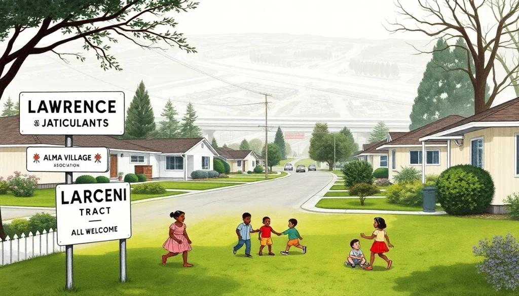
A 1956 subdivision map, filed with the Santa Clara County Recorder, shows the original lot layout with the curved street of Lawrence Lane and the cul-de-sac Orchard Way. This map is crucial for understanding the tract’s intended design as a typical suburban enclave. A series of photographs taken by a Palo Alto Times photographer in 1958, now in the Palo Alto Historical Association’s “South Palo Alto” collection, capture the neighborhood at its peak: children of different races playing in a sprinkler, a multiracial group of women at a potluck, and a sign reading “Lawrence Tract Community Association—All Welcome.” No known photographs of the original dairy farm exist, but a 1948 aerial survey by the U.S. Geological Survey shows the site as open fields with a few farm buildings, providing a baseline for the transformation.
Historiographical Notes
The story of the Lawrence Tract has been largely absent from official Palo Alto histories, which tend to emphasize the city’s progressive image and technological innovation. Early county histories, written in the 1970s, mention the tract only as a “blighted area” cleared for redevelopment, erasing its intentional integration. Revisionist work began in the 1990s, led by local historian Margaret F. Johnson, whose oral history project “Voices of the Lawrence Tract” (1998) recovered the experiences of former residents. More recently, scholars of suburban segregation have used the tract as a case study of how federal housing policy and local real estate practices undermined integrated communities. The narrative remains contested: some former white residents describe the experiment as a success that was killed by outside speculators, while Black former residents point to the city’s complicity in disinvestment and eventual displacement.
Sources and Archives
The most important repository is the Palo Alto Historical Association, which holds the “Lawrence Tract Collection” (Accession 1998-045), including oral history transcripts, photographs, and the original 1956 brochure. The Santa Clara County Recorder’s Office maintains the subdivision map and property deeds. The Palo Alto City Clerk’s archives contain the 1975 eminent domain resolutions and city council minutes. The Palo Alto Times and San Francisco Chronicle are available through the Palo Alto City Library’s digital newspaper archive. Stanford University’s Special Collections holds the papers of the Palo Alto Interracial Housing Council (SCM0432), which include correspondence and meeting minutes. The California Room at the San Jose Public Library has a file of clippings on fair housing in Santa Clara County.
Related People and Places
John H. Lawrence (1911–1987): The developer and Quaker activist who subdivided his family’s farm with the explicit goal of creating an integrated community. He later moved to a cooperative farm in the Central Valley after the tract’s decline.
Margaret F. Johnson (1925–2010): Local historian and former Stanford librarian who conducted the oral history project that preserved the tract’s memory. Her work remains the foundational source for all subsequent research.
Reverend James E. Jones (1918–1995): Pastor of the First African Methodist Episcopal Church in Palo Alto and a key organizer of the Interracial Housing Council. He personally recruited Black families to move into the tract.
Ventura Tract: A smaller, earlier attempt at integrated housing in East Palo Alto (then unincorporated) in 1950, which faced similar pressures and was eventually absorbed into the Ravenswood City School District area.
Oregon Expressway: The physical barrier that isolated the tract from the rest of Palo Alto, built in the early 1960s as part of a larger freeway plan that was never completed. Its construction accelerated the neighborhood’s decline.
FAQ
What was the Lawrence Tract?
The Lawrence Tract was a small subdivision in Palo Alto, California, developed in 1955 as an intentional experiment in racially integrated housing. It was one of the first suburban communities in the region to market homes on an open-occupancy basis, attracting both white and Black families.
Why did the Lawrence Tract fail?
The tract declined due to a combination of blockbusting by real estate speculators, racial steering, disinvestment by absentee landlords, and the city’s decision to rezone the area for commercial use. By the late 1970s, all residents were displaced through eminent domain.
Are there any remaining buildings from the Lawrence Tract?
No original homes survive. The site is now occupied by the Alma Village shopping center and medical offices. A small plaque on the shopping center wall commemorates the experiment, and a row of eucalyptus trees from the original farm remains along Alma Street.
Where can I learn more about the people who lived there?
The Palo Alto Historical Association holds an oral history collection titled 'Voices of the Lawrence Tract,' which includes interviews with former residents. Transcripts and some audio recordings are available to researchers by appointment.
Leave a Reply